Area Overview for BD21 3JJ
Photos of BD21 3JJ

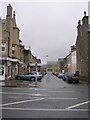
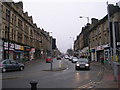
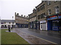
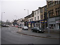
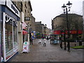
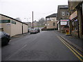
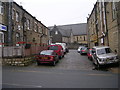
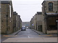
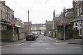
100 photos from this area
Area Information
Key information about the BD21 3JJ including its size, population, and administrative classification.
- Area Type
- Postcode
- Area Size
- 2164 m²
- Population
- 1505
- Population Density
- 15187 people/km²
House Prices in BD21 3JJ
19
Properties
£53,645
Average Sold Price
£22,400
Lowest Price
£85,000
Highest Price
Showing 19 properties
| Address | Type | Beds | Baths | Last Sale Price | Last Sale Date | |
|---|---|---|---|---|---|---|
| 11 Victoria Avenue, Keighley, BD21 3JJ | house | - | - | £57,750 | Dec 2017 | |
| 6 Victoria Avenue, Keighley, BD21 3JJ | Terraced | 4 | 1 | £78,000 | Jun 2017 | |
| 15 Victoria Avenue, Keighley, BD21 3JJ | house | - | - | £75,000 | Oct 2015 | |
| 7 Victoria Avenue, Keighley, BD21 3JJ | Terraced | 4 | 1 | £85,000 | Jul 2015 | |
| 9 Victoria Avenue, Keighley, BD21 3JJ | house | 3 | - | £63,750 | Jul 2012 | |
| 5 Victoria Avenue, Keighley, BD21 3JJ | house | - | - | £85,000 | Oct 2009 | |
| 19 Victoria Avenue, Keighley, BD21 3JJ | house | - | - | £35,200 | Aug 2004 | |
| 1 Victoria Avenue, Keighley, BD21 3JJ | Terraced | - | - | £22,400 | Dec 2000 | |
| 17 Victoria Avenue, Keighley, BD21 3JJ | Terraced | - | - | £26,500 | Dec 1998 | |
| 10-12 Victoria Avenue, Keighley, BD21 3JJ | Terraced | - | - | £32,500 | Mar 1997 |
Page 1 of 2
Energy Efficiency in BD21 3JJ
Amenities
Schools
| Rank | School | Type | Entry gender | Ages |
|---|
Explore more schools in this area
Go to Schools tabDemographics
Household Size
Family (3-5 people)
most common
Accommodation Type
Houses
most common
Tenure
51
majority
Ethnic Group
asian_total
most common
Religion
N/A
most common
Household Composition
N/A
most common
Age
22
median
Adults (30-64 years)
most common
Household Deprivation
N/A
with no deprivation
NS-SEC
10
in Lower managerial occupations
Explore more demographic insights in this area
Go to Demographics tabPlanning
Planning Constraints
- Flood RiskPremium
- Ramsar Wetland SitesPremium
- Area of Outstanding Natural BeautyPremium
- Protected Nature ReservePremium
- Protected WoodlandPremium