Area Overview for BD21 3EE
Photos of BD21 3EE
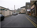
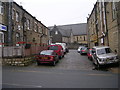
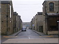
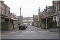
100 photos from this area
Area Information
Key information about the BD21 3EE including its size, population, and administrative classification.
- Area Type
- Postcode
- Area Size
- 4338 m²
- Population
- 1505
- Population Density
- 15187 people/km²
House Prices in BD21 3EE
29
Properties
£51,469
Average Sold Price
£10,000
Lowest Price
£95,000
Highest Price
Showing 29 properties
| Address | Type | Beds | Baths | Last Sale Price | Last Sale Date | |
|---|---|---|---|---|---|---|
| 103 Emily Street, Keighley, BD21 3EE | house | - | - | £95,000 | Jul 2025 | |
| 91 Emily Street, Keighley, BD21 3EE | house | 3 | - | £50,000 | Aug 2022 | |
| 121 Emily Street, Keighley, BD21 3EE | Flat | - | - | £75,000 | Sep 2019 | |
| 115 Emily Street, Keighley, BD21 3EE | Terraced | 1 | 1 | £39,000 | Apr 2019 | |
| 101 Emily Street, Keighley, BD21 3EE | house | 4 | 1 | £78,000 | Feb 2019 | |
| 100 Emily Street, Keighley, BD21 3EE | house | - | - | £95,000 | Feb 2017 | |
| 98 Emily Street, Keighley, BD21 3EE | Terraced | - | - | £85,000 | Jun 2008 | |
| 95 Emily Street, Keighley, BD21 3EE | house | 3 | 1 | £22,500 | Mar 2008 | |
| 105 Emily Street, Keighley, BD21 3EE | Terraced | - | - | £95,000 | Apr 2007 | |
| 93 Emily Street, Keighley, BD21 3EE | house | - | - | £39,000 | Aug 2006 |
Page 1 of 3
Energy Efficiency in BD21 3EE
Amenities
Schools
| Rank | School | Type | Entry gender | Ages |
|---|
Explore more schools in this area
Go to Schools tabDemographics
Household Size
Family (3-5 people)
most common
Accommodation Type
Houses
most common
Tenure
51
majority
Ethnic Group
asian_total
most common
Religion
N/A
most common
Household Composition
N/A
most common
Age
22
median
Adults (30-64 years)
most common
Household Deprivation
N/A
with no deprivation
NS-SEC
10
in Lower managerial occupations
Explore more demographic insights in this area
Go to Demographics tabPlanning
Planning Constraints
- Flood RiskPremium
- Ramsar Wetland SitesPremium
- Area of Outstanding Natural BeautyPremium
- Protected Nature ReservePremium
- Protected WoodlandPremium