Area Overview for BD21 2SQ
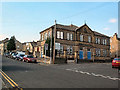
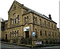
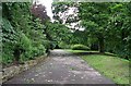
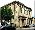
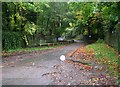
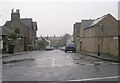
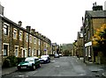
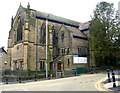
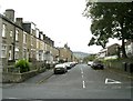
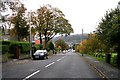
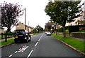
Photos of BD21 2SQ

Area Information
BD21 2SQ is a small, tightly knit residential postcode area in the town of Keighley, West Yorkshire. With a population of 1,582, it reflects the character of a historic market town that evolved from rural origins into a modern community. The area is part of the City of Bradford district, situated near the confluence of the North Beck, Worth, and Aire rivers. Daily life here balances the quiet charm of a small town with proximity to transport links and amenities. The postcode covers a cluster of homes, primarily owner-occupied, with a median age of 22, though the most common age range for residents is 30–64. This suggests a mix of younger and established households. The area’s demographics highlight a strong Asian presence, reflecting broader trends in the region. Living in BD21 2SQ offers access to local schools, retail, and transport networks, while retaining the low-key appeal of a town with roots in the Industrial Revolution’s wool textile industry.
- Area Type
- Postcode
- Area Size
- Not available
- Population
- 1582
- Population Density
- Not available
The property market in BD21 2SQ is dominated by owner-occupied homes, with 58% of residents owning their properties. The area’s accommodation type is primarily houses, which is notable in a region where flats or terraced housing might be more common. This suggests a focus on family-friendly or semi-detached housing stock. Given the postcode’s small size and limited population, the housing supply is likely constrained, meaning buyers may need to consider nearby areas for more options. The high home ownership rate indicates a stable market, but the absence of rental data means it is unclear whether the area is a rental hotspot or predominantly owner-occupied. For buyers, the presence of houses may appeal to those seeking space and privacy, though the small scale of the area could limit availability. Proximity to transport links and schools adds to the area’s appeal for families and professionals.
House Prices in BD21 2SQ
No properties found in this postcode.
Energy Efficiency in BD21 2SQ
Living in BD21 2SQ offers a blend of practicality and accessibility. The area’s retail options include five notable venues: Farmfoods Eastwood, Morrisons Eastwood, and Sainsburys Keighley, providing a range of grocery and convenience shopping. Public transport is well-served by five rail stations and five metro stops, including Keighley Railway Station and Ingrow West, facilitating easy travel to nearby towns and cities. While parks and leisure facilities are not explicitly listed in the data, the presence of multiple transport hubs suggests proximity to recreational areas. The community’s small size fosters a sense of familiarity, with amenities clustered to serve daily needs. This balance of retail, transport, and connectivity contributes to a lifestyle that prioritises convenience without sacrificing the character of a small town.
Amenities
Schools
Residents of BD21 2SQ have access to two primary schools: Victoria Primary School and Highfield Middle School. Both are primary institutions, though Highfield Middle School’s name might suggest a secondary role, which is not clarified in the data. Victoria Primary School has an Ofsted rating of “good,” indicating a reliable standard of education. The presence of two primary schools within the area provides families with options for their children’s early education. However, the absence of secondary schools or further education facilities in the data means that students may need to travel to nearby towns for higher-level schooling. The concentration of primary schools suggests a focus on supporting younger families, though the lack of detailed performance metrics for Highfield Middle School leaves some uncertainty about its quality.
| Rank | School | Type | Entry gender | Ages |
|---|
Explore more schools in this area
Go to Schools tabDemographics
The community in BD21 2SQ has a median age of 22, though the most common age range among residents is 30–64 years. This indicates a balance between younger and middle-aged households. Home ownership is high at 58%, with houses being the predominant type of accommodation. The area’s ethnic composition is marked by a strong Asian presence, as noted in the data. This diversity shapes the local character, though specific details on other ethnic groups are not provided. The area’s relatively small population of 1,582 means it is not densely populated, contributing to a quieter, more community-focused atmosphere. While no explicit deprivation data is given, the high home ownership rate and presence of amenities suggest a stable quality of life. The mix of age groups and household types implies a dynamic yet cohesive neighbourhood, though the lack of detailed socioeconomic data limits further analysis.
Household Size
Accommodation Type
Tenure
Ethnic Group
Religion
Household Composition
Age
Household Deprivation
NS-SEC
Explore more demographic insights in this area
Go to Demographics tabPlanning
Planning Constraints
- Flood RiskPremium
- Ramsar Wetland SitesPremium
- Area of Outstanding Natural BeautyPremium
- Protected Nature ReservePremium
- Protected WoodlandPremium