Area Overview for BD21 2RH
Photos of BD21 2RH

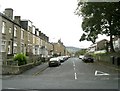
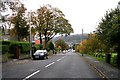
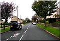
100 photos from this area
Area Information
Key information about the BD21 2RH including its size, population, and administrative classification.
- Area Type
- Postcode
- Area Size
- 1733 m²
- Population
- 1862
- Population Density
- 8787 people/km²
House Prices in BD21 2RH
6
Properties
£53,500
Average Sold Price
£32,500
Lowest Price
£68,000
Highest Price
Showing 6 properties
| Address | Type | Beds | Baths | Last Sale Price | Last Sale Date | |
|---|---|---|---|---|---|---|
| 157 Redcliffe Street, Keighley, BD21 2RH | Semi-detached | 2 | 1 | £68,000 | Feb 2020 | |
| 159 Redcliffe Street, Keighley, BD21 2RH | Semi-detached | 2 | 1 | £66,000 | Jan 2016 | |
| 155 Redcliffe Street, Keighley, BD21 2RH | Semi-detached | - | - | £65,000 | Apr 2012 | |
| 149 Redcliffe Street, Keighley, BD21 2RH | Semi-detached | - | - | £36,000 | Jun 2001 | |
| 153 Redcliffe Street, Keighley, BD21 2RH | Semi-detached | - | - | £32,500 | Jun 1999 | |
| 151 Redcliffe Street, Keighley, BD21 2RH | house | 2 | - | - | - |
Energy Efficiency in BD21 2RH
Amenities
Schools
| Rank | School | Type | Entry gender | Ages |
|---|
Explore more schools in this area
Go to Schools tabDemographics
Household Size
Family (3-5 people)
most common
Accommodation Type
Houses
most common
Tenure
67
majority
Ethnic Group
asian_total
most common
Religion
N/A
most common
Household Composition
N/A
most common
Age
22
median
Adults (30-64 years)
most common
Household Deprivation
N/A
with no deprivation
NS-SEC
14
in Lower managerial occupations
Explore more demographic insights in this area
Go to Demographics tabPlanning
Planning Constraints
- Flood RiskPremium
- Ramsar Wetland SitesPremium
- Area of Outstanding Natural BeautyPremium
- Protected Nature ReservePremium
- Protected WoodlandPremium