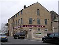
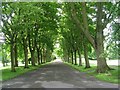
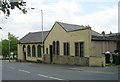
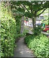
Area Overview for BD21 1AU
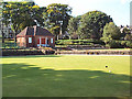
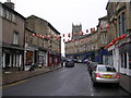
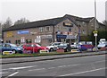
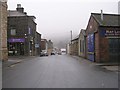
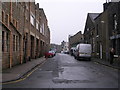
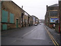
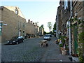
Photos of BD21 1AU
Area Information
Ringrose Gate in the BD21 1AU postcode represents a tight-knit residential cluster within the broader Keighley area. This specific location covers just 7359 square metres, creating a high-density environment where 1382 people reside. The population density reaches 187,809 people per square kilometre, indicating a very compact neighbourhood layout typical of this postcode area. You are buying into a space defined by its small physical footprint but significant local occupancy. Keighley itself sits in the West Yorkshire district, historically evolving from a rural settlement near river fords into a modern town with deep roots dating back to the Domesday Book of 1086. Living in BD21 1AU means accepting a setting that is part of this larger historical fabric while maintaining close quarters with neighbours. The area functions as a concentrated residential zone rather than a sprawling suburb. Residents navigate a daily life characterised by proximity to local amenities and the immediate town centre environment. This compact size ensures that essential services and community hubs are within walking distance or a short drive. The postcode serves as a specific identifier for this residential cluster, offering a distinct choice for those seeking a situated lifestyle within the City of Bradford district.
- Area Type
- Postcode
- Area Size
- 7359 m²
- Population
- 1382
- Population Density
- 7511 people/km²
The housing landscape in BD21 1AU is defined by a strong ownership culture with home ownership levels reaching 58 per cent. This statistic confirms that the majority of dwellings here are owned by their occupants rather than being part of the private rental sector. Because households own their properties, the market likely features a steady stream of estate agent sales rather than constant migration between landlords and tenants. The predominant accommodation type is houses, which suggests a stock of family-sized properties rather than urban flats or studio apartments. Buying a home in this postcode means entering an environment where residents generally intend to stay long term. The small area size of 7359 square metres concentrates this housing stock, so inventory can be limited compared to larger suburban districts. You should expect to find solid, traditional homes rather than modern high-rise developments or new-build apartments. The 58 per cent ownership rate indicates that first-time buyers may find existing on-the-market properties alongside shared ownership or inherited family homes. Prices will reflect the specific characteristics of these houses within the tight geographical bounds of the BD21 1AU cluster.
House Prices in BD21 1AU
Showing 36 properties
| Address | Type | Beds | Baths | Last Sale Price | Last Sale Date | |
|---|---|---|---|---|---|---|
| 17 Rawling Street, Keighley, BD21 1AU | Terraced | 2 | 1 | £61,000 | Mar 2025 | |
| 27 Rawling Street, Keighley, BD21 1AU | Terraced | 3 | 1 | £90,000 | Mar 2023 | |
| 38 Rawling Street, Keighley, BD21 1AU | Terraced | 2 | 1 | £95,000 | Mar 2023 | |
| 31 Rawling Street, Keighley, BD21 1AU | house | 2 | 1 | £85,000 | Aug 2022 | |
| 49 Rawling Street, Keighley, BD21 1AU | house | 4 | 1 | £120,000 | Aug 2022 | |
| 45 Rawling Street, Keighley, BD21 1AU | Retail | 3 | 1 | £110,000 | Mar 2022 | |
| 24 Rawling Street, Keighley, BD21 1AU | Terraced | 2 | 1 | £80,750 | Dec 2021 | |
| 7 Rawling Street, Keighley, BD21 1AU | Terraced | 2 | 1 | £64,950 | Sep 2021 | |
| 5 Rawling Street, Keighley, BD21 1AU | house | 2 | - | £61,500 | Feb 2021 | |
| 6 Rawling Street, Keighley, BD21 1AU | Terraced | 2 | 1 | £75,000 | Jan 2020 |
Energy Efficiency in BD21 1AU
Daily life in BD21 1AU places you within practical reach of several convenience retailers and transport hubs. Morrisons Daily, Co-op Broomhill, and Morrisons Eastwood provide nearby options for groceries and household essentials. These five retail outlets ensure you do not need to travel far for daily shopping needs. For leisure travel, five metro and rail connections remain within reach, including stops at Ingrow West, Damems, and Oakworth. Further travel is facilitated by three railway stations: Keighley Railway Station, Crossflatts Railway Station, and Steeton & Silsden Railway Station. You can access regional rail networks without difficulty. This amenity profile creates a convenient lifestyle where errands and commuting are manageable quickly. The variety of nearby venues ensures that practical needs are met efficiently. Families life in BD21 1AU involves easy access to both local shopping and broader transport links. The proximity of these specific shops and stations means you value time spent away from home during the day.
Amenities
Schools
Families living in BD21 1AU benefit from access to several primary education institutions located nearby. Ingrow Primary School operates in the area and holds a good Ofsted rating, providing a formally accredited primary education option. St Joseph's Catholic Primary School is another nearby choice for families seeking denominational education, though no Ofsted rating is currently assigned in the available information. These schools cater to the early years of compulsory education for children in the neighbourhood. The presence of multiple primary options suggests local demand for infant and junior schooling, even if junior secondary institutions are not listed in the immediate vicinity. For parents considering moving to BD21 1AU, these two named schools represent the primary educational resources available. You would likely attend either Ingrow Primary or St Joseph's if you had a child of primary school age. The mix of state-funded and faith-based primary provision allows families to choose based on educational values or location convenience. Finding schools near BD21 1AU requires checking catchment boundaries for these specific institutions as property markets can shift.
| Rank | School | Type | Entry gender | Ages |
|---|
Explore more schools in this area
Go to Schools tabDemographics
The community within BD21 1AU reflects a settled population with a median age of 47 years. Most residents fall into the adult age range of 30 to 64 years, suggesting a demographic dominated by working-age families or established households. Unlike younger university-focused zones or retirement enclaves, this area attracts people in their prime working years. Home ownership stands at 58 per cent, meaning more than half of the residents own their properties outright or have a mortgage. This figure points towards a stable community where long-term residence is common rather than a transient rental marketplace. The predominant ethnic group in the accommodation is White, which aligns with the broader West Yorkshire demographic profile. Houses form the primary accommodation type, indicating that detached or semi-detached family homes are the norm rather than high-density flats or city apartments. Living in homes in BD21 1AU typically involves traditional British property stock suitable for families. The data shows a clear preference for single-family dwellings within this small postcode. These demographic facts paint a picture of a neighbourhood where residents have largely put down roots. The age profile suggests quiet evenings but also potential pressure on local schools as children reach senior years.
Household Size
Accommodation Type
Tenure
Ethnic Group
Religion
Household Composition
Age
Household Deprivation
NS-SEC
Explore more demographic insights in this area
Go to Demographics tabPlanning
Planning Constraints
- Flood RiskPremium
- Ramsar Wetland SitesPremium
- Area of Outstanding Natural BeautyPremium
- Protected Nature ReservePremium
- Protected WoodlandPremium