Area Overview for BD2 1PS
Photos of BD2 1PS
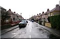
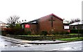
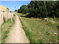
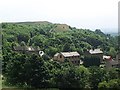
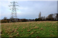
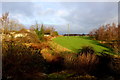
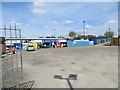
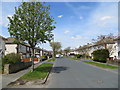
100 photos from this area
Area Information
Key information about the BD2 1PS including its size, population, and administrative classification.
- Area Type
- Postcode
- Area Size
- 4521 m²
- Population
- 1778
- Population Density
- 393289 people/km²
House Prices in BD2 1PS
12
Properties
£146,111
Average Sold Price
£50,000
Lowest Price
£240,000
Highest Price
Showing 12 properties
| Address | Type | Beds | Baths | Last Sale Price | Last Sale Date | |
|---|---|---|---|---|---|---|
| 180 Wrose Road, Bradford, BD2 1PS | Semi-detached | 3 | 1 | £195,000 | Dec 2025 | |
| 170 Wrose Road, Bradford, BD2 1PS | Semi-detached | 3 | 1 | £240,000 | Aug 2023 | |
| 168 Wrose Road, Bradford, BD2 1PS | Semi-detached | 3 | - | £230,000 | Jun 2022 | |
| 176 Wrose Road, Bradford, BD2 1PS | Semi-detached | 3 | 1 | £90,000 | Oct 2019 | |
| 182 Wrose Road, Bradford, BD2 1PS | Semi-detached | 3 | 1 | £124,000 | Jun 2019 | |
| 166 Wrose Road, Bradford, BD2 1PS | Semi-detached | 3 | 1 | £145,000 | Aug 2018 | |
| 178 Wrose Road, Bradford, BD2 1PS | Semi-detached | 3 | 1 | £156,000 | Apr 2015 | |
| 162 Wrose Road, Bradford, BD2 1PS | house | - | - | £85,000 | Oct 2002 | |
| 174 Wrose Road, Bradford, BD2 1PS | Semi-detached | - | - | £50,000 | Nov 1997 | |
| 164 Wrose Road, Bradford, BD2 1PS | Semi-detached | - | - | - | - |
Page 1 of 2
Energy Efficiency in BD2 1PS
Amenities
Schools
| Rank | School | Type | Entry gender | Ages |
|---|
Explore more schools in this area
Go to Schools tabDemographics
Household Size
Family (3-5 people)
most common
Accommodation Type
Houses
most common
Tenure
87
majority
Ethnic Group
White
most common
Religion
N/A
most common
Household Composition
N/A
most common
Age
47
median
Adults (30-64 years)
most common
Household Deprivation
N/A
with no deprivation
NS-SEC
29
in Lower managerial occupations
Explore more demographic insights in this area
Go to Demographics tabPlanning
Planning Constraints
- Flood RiskPremium
- Ramsar Wetland SitesPremium
- Area of Outstanding Natural BeautyPremium
- Protected Nature ReservePremium
- Protected WoodlandPremium