Area Overview for BD2 1JA
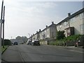
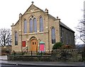
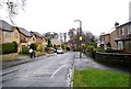
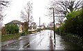
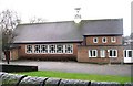
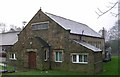
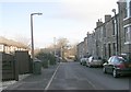
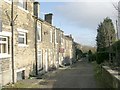
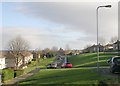
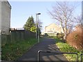
Photos of BD2 1JA
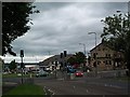
Area Information
Living in BD2 1JA means residing within Bolton and Undercliffe, a specific residential cluster in the City of Bradford Metropolitan District Council. This postcode covers a small area of approximately 3,178 square metres, hosting a population of around 1,600 people. The ward known as Bolton and Undercliffe sits northeast of the Bradford city centre, situated east of Bradford Beck. It lies between Shipley and Wrose to the north and central Bradford to the south. The geography includes the former village of Bolton, which merged with the district in the 19th century, and Undercliffe, an area recorded historically as being below a cliff spur. Approximately 80 per cent of residents in this wider ward report good or very good health. The community is largely urban and almost entirely residential, focusing on maintaining decent homes and safe neighbourhoods. You will find here a mix of established streets and local history, including sites like the Dudley Hill to Killinghall turnpike route of 1804. This location offers proximity to significant transport hubs while remaining a quiet, suburban enclave within the larger metropolitan structure.
- Area Type
- Postcode
- Area Size
- 3178 m²
- Population
- 1599
- Population Density
- 6186 people/km²
Homes in BD2 1JA are primarily houses, aligning with the national trend for semi-detached properties and bungalows that makes up more than half of the local housing stock. The area supports a balanced mix of ownership and rental living, with home ownership levels recorded at 52 per cent. This suggests a neighbourhood where residents value stability and long-term settlement, rather than a transient market dominated by short-term lets. The accommodation type data indicates a preference for detached or semi-detanced structures, typical of suburban developments found east of Bradford Beck. Prospective buyers looking at this small postcode cluster should expect established residential estates rather than high-density apartments. The higher-than-average ownership figures in similar wards point towards a stable environment where families stay put. As part of the Bolton and Undercliffe ward, you can anticipate familiar property layouts, potentially featuring the historic small mansions noted at Guy's Cliffe from the mid-19th century. The 5.9 per cent overcrowding rate in the wider area is higher than the district average, implying that larger family homes are in demand and single-person units may be harder to source without multiple occupants inside one dwelling.
House Prices in BD2 1JA
Showing 8 properties
| Address | Type | Beds | Baths | Last Sale Price | Last Sale Date | |
|---|---|---|---|---|---|---|
| 5 Moorhouse Avenue, Bradford, BD2 1JA | house | - | - | £144,500 | May 2023 | |
| 6 Moorhouse Avenue, Bradford, BD2 1JA | house | - | - | £100,000 | Oct 2020 | |
| 2 Moorhouse Avenue, Bradford, BD2 1JA | Semi-detached | 2 | 1 | £76,000 | Sep 2004 | |
| 3 Moorhouse Avenue, Bradford, BD2 1JA | house | - | - | £38,000 | Dec 2000 | |
| 10 Moorhouse Avenue, Bradford, BD2 1JA | Semi-detached | - | - | £37,500 | Jun 2000 | |
| 8 Moorhouse Avenue, Bradford, BD2 1JA | Semi-detached | - | - | £29,000 | Mar 1996 | |
| 1 Moorhouse Avenue, Bradford, BD2 1JA | Semi-detached | - | - | - | - | |
| 4 Moorhouse Avenue, Bradford, BD2 1JA | house | - | - | - | - |
Energy Efficiency in BD2 1JA
Your daily life in BD2 1JA is defined by convenient access to retail and transport hubs within practical reach. You can shop at Morrisons Eccleshill, Tesco Bradford, and Co-op Eccleshill, ensuring grocery needs are met without travelling far. For commuting, five railway stations lie nearby, including Frizinghall, Shipley, and Bradford Forster Square, offering multiple routes for daily travel. Two airports, Leeds Bradford Airport and Leeds Bradford International Airport, provide international connectivity for business or leisure trips. The immediate surroundings include historic landmarks such as Peel Park, which features Grade II listed buildings like entrance lodges, statues, and drinking fountains. Bradford Cemetery with listed memorials sits as a significant local site. Transport links are substantial, with five identified railway connections facilitating easy access to broader Yorkshire and London. The presence of various retail chains and major rail nodes means you do not need to venture far into the city centre for essentials or weekend outings. This balance of quiet residential living backed by strong commercial and transport infrastructure defines the practical day-to-day experience for residents here.
Amenities
Schools
Families moving to BD2 1JA have access to specific educational institutions within the local ward. Swain House Primary School operates as a primary school holding a 'good' Ofsted rating, offering quality early education to young children. Swain House Middle School also serves the community, providing secondary education for older children within the same geographical footprint. The presence of both primary and middle stages in Swain House indicates that families can keep their children in the same educational complex as they progress from early years into later childhood. This setup reduces the necessity for moving regions when children transition between early primary and later primary years. For homebuyers prioritising education, these two named schools form the core of the local academic offer. While the wider Bolton and Undercliffe ward ranks 15th out of 30 for deprivation, the specific 'good' rating assigned to Swain House Primary School provides a positive indicator for parents seeking reliable state education options directly near their home.
| Rank | School | Type | Entry gender | Ages |
|---|
Explore more schools in this area
Go to Schools tabDemographics
The community in BD2 1JA reflects the broader character of Bolton and Undercliffe, where the median age is 47 years. The most common age group consists of adults between 30 and 64 years old, suggesting a mature demographic rather than a youthful housing market. House ownership stands at 52 per cent, indicating that slightly more households rent their homes than own them outright. The prevailing accommodation type comprises houses, consistent with the ward statistic showing that 54.6 per cent of the Total 6,650 households are semi-detached houses or bungalows. While the provided postcode data lists the predominant ethnic group as White, the wider ward context highlights a diverse population where White residents make up 53 per cent, alongside significant Pakistani and Bangladeshi communities. Deprivation levels within the ward rank 15th out of 30 Bradford wards, signalling moderate challenges across income, employment, and education rather than severe deprivation. With an average age of 36.6 years across the entire ward and 24.1 per cent of residents under 16, families remain a noticeable part of the local fabric despite the older median age figure.
Household Size
Accommodation Type
Tenure
Ethnic Group
Religion
Household Composition
Age
Household Deprivation
NS-SEC
Explore more demographic insights in this area
Go to Demographics tabPlanning
Planning Constraints
- Flood RiskPremium
- Ramsar Wetland SitesPremium
- Area of Outstanding Natural BeautyPremium
- Protected Nature ReservePremium
- Protected WoodlandPremium