Area Overview for BD19 6JY
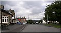
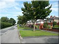
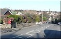
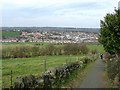
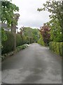
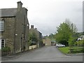
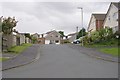
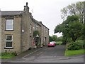
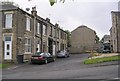
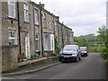
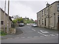
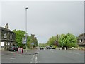
Photos of BD19 6JY
Area Information
BD19 6JY occupies a specific residential cluster measuring just 1.1 hectares. This small footprint supports a population of 1,649 people, creating a densely packed living environment with a density of 1,462 people per square kilometre. Located within the broader Kirklees district, this postcode represents a quiet, established residential zone rather than a high-rise or urban sprawl. The area is defined by its compact size and concentrated community feel, offering a close-knit atmosphere for those seeking housing in a defined geographical patch. Residents here navigate daily life within a small boundary where neighbours are likely to know one another due to the high household density. The area functions as a self-contained residential block, separate from the wider commercial centres of nearby towns like Cleckheaton. Its small area size means the distance between homes is short, fostering a sense of locality. However, the lack of significant open space within the 1.1 hectare limit suggests that residents typically rely on external areas for leisure and greenery. This specific postcode offers a straightforward, low-profile living situation suitable for those who prioritise a compact, community-focused address over expansive grounds.
- Area Type
- Postcode
- Area Size
- 1.1 hectares
- Population
- 1649
- Population Density
- 1462 people/km²
The property market in BD19 6JY is dominated by owner-occupiers. A full 76% of homes in this postcode are owned by residents, creating a stable and non-transient housing stock. This is a solid area for buyers looking to purchase, as the majority of sellers are individuals with a vested interest in stabilising their neighbourhood. The accommodation type is strictly houses, meaning there are no flats or apartments for rent or sale within this specific cluster. This composition suggests that the area appeals to families or individuals seeking traditional detached or semi-detached homes rather than urban living. The low rental percentage implies that the local demand is driven by people buying to stay, rather than investors or corporate tenants. If you are looking at homes in BD19 6JY, you are entering a market defined by ownership. The 1.1 hectare size of the postcode indicates a small, defined market that does not fluctuate with broader market trends as dramatically as larger districts. This area offers a reliable option for those prioritising a house in an established, owner-led environment.
House Prices in BD19 6JY
Showing 7 properties
| Address | Type | Beds | Baths | Last Sale Price | Last Sale Date | |
|---|---|---|---|---|---|---|
| 6, Moorland Mount, Moorside, Cleckheaton, BD19 6JY | house | - | - | £325,000 | Jun 2019 | |
| 1, Moorland Mount, Moorside, Cleckheaton, BD19 6JY | Terraced | - | - | £225,000 | Dec 2004 | |
| 5, Moorland Mount, Moorside, Cleckheaton, BD19 6JY | Terraced | - | - | £88,500 | Oct 2001 | |
| 3, Moorland Mount, Moorside, Cleckheaton, BD19 6JY | Terraced | - | - | £86,700 | Sep 2001 | |
| 4, Moorland Mount, Moorside, Cleckheaton, BD19 6JY | house | - | - | £67,000 | Nov 1999 | |
| 2, Moorland Mount, Moorside, Cleckheaton, BD19 6JY | Terraced | - | - | - | - | |
| 7, Moorland Mount, Moorside, Cleckheaton, BD19 6JY | Terraced | - | - | - | - |
Energy Efficiency in BD19 6JY
Residents of BD19 6JY enjoy convenient access to a range of amenities within practical reach. For retail needs, five major locations are nearby, including the Waitrose at Harts, Tesco Cleckheaton, and the Co-op Scholes. These venues provide ample choice for groceries and daily shopping without needing to travel long distances. Transport links include five railway stations, with Brighouse Railway Station, Low Moor Railway Station, and Deighton Railway Station serving as key hubs for commuting. While the immediate area is a 1.1 hectare residential zone, the surrounding infrastructure supports a varied lifestyle. You can access quality retail at Waitrose and essential superstores at Tesco and Co-op. The proximity to multiple rail stations means that travelling to larger cities is straightforward, despite the local cluster being primarily residential. This combination of nearby shopping and good rail access offers a balance between the quiet of home life and the convenience of city transit. Living in BD19 6JY means you have self-contained housing with neither shopping nor travel to compromise your daily routine.
Amenities
Schools
Families in BD19 6JY benefit from proximity to St Luke's Church of England Voluntary Controlled First School. This primary school serves the educational needs of younger children within the catchment area. While there are no secondary schools listed for this specific postcode, the presence of a voluntary controlled first school indicates a focus on early education within the immediate vicinity. The school mix consists solely of primary education at this level. For residents with older children who require secondary education, they would look beyond this specific 1.1 hectare area to other institutions not listed in the immediate data. The existence of St Luke's suggests that the local community supports young families through elementary education. When considering living in BD19 6JY, you have a named primary institution nearby, though the full spectrum of schooling requires looking further out. This specific provision aligns with the high home ownership rate, as families often prioritise local primary schools before later schooling.
| Rank | School | Type | Entry gender | Ages |
|---|
Explore more schools in this area
Go to Schools tabDemographics
The community living in BD19 6JY is mature and stable. The median age stands at 47 years, indicating a resident base dominated by adults between 30 and 64 years old. This age profile suggests the area attracts homeowners looking for quiet living rather than young families just entering the property market or teenagers. Home ownership is high at 76%, reflecting a settled market where residents have invested locally rather than renting transiently. Accommodation types are exclusively houses, with no flats or apartments recorded for this postcode. The predominant ethnic group is White, mirroring the broader demographic trend of the region. With a population density of 1,462 people per square kilometre, the area is built up, yet the high home ownership rate means most streets feature long-term residents rather than short-term tenancies. The absence of a younger demographic or significant rental population points to a quiet, established neighbourhood. These figures indicate that if you are considering moving here, you are entering a area where the majority of inhabitants have put down roots and own their property outright.
Household Size
Accommodation Type
Tenure
Ethnic Group
Religion
Household Composition
Age
Household Deprivation
NS-SEC
Explore more demographic insights in this area
Go to Demographics tabPlanning
Planning Constraints
- Flood RiskPremium
- Ramsar Wetland SitesPremium
- Area of Outstanding Natural BeautyPremium
- Protected Nature ReservePremium
- Protected WoodlandPremium