Area Overview for BD19 6HZ
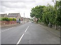
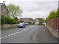
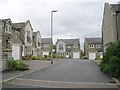
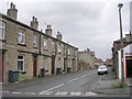
Photos of BD19 6HZ
Area Information
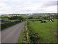
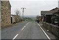
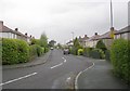
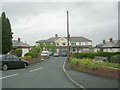
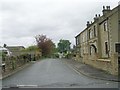
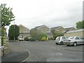
Living in BD19 6HZ means inhabiting a small, tightly knit residential cluster in England’s West Yorkshire, where the population of 1,417 is spread across a densely populated area of 1385 people per square kilometre. This postcode sits within the historically industrious Spen Valley, a region once defined by its textile manufacturing legacy. The area’s compact nature fosters a quiet, community-focused atmosphere, with homes predominantly owner-occupied and centred on traditional housing stock. While the town of Cleckheaton, nearby, bears the marks of its industrial past, BD19 6HZ itself is a modern residential pocket with minimal planning constraints. Its proximity to rail networks and retail hubs, combined with low environmental risks, makes it a pragmatic choice for those prioritising safety, connectivity, and ease of access to nearby services. The area’s demographic profile—skewed toward adults aged 30–64—suggests a stable, established community with a focus on long-term living rather than transient populations.
- Area Type
- Postcode
- Area Size
- Not available
- Population
- 1417
- Population Density
- 1385 people/km²
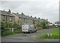
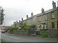
BD19 6HZ is a small area where 80 per cent of homes are owner-occupied, a strong indicator of a stable, long-term residential market. The accommodation type is predominantly houses, which suggests a focus on traditional, family-sized properties rather than apartments or rental units. This owner-occupied model implies a low turnover of properties, with buyers likely seeking established homes in a compact, well-connected area. The immediate surroundings offer limited data on property diversity, but the absence of planning constraints such as protected woodlands or areas of outstanding natural beauty means development restrictions are minimal. For buyers, this means a straightforward purchasing process, though the small size of the area may limit options. The housing stock’s emphasis on houses also caters to families or those preferring larger living spaces, making it a niche but practical choice for specific buyer profiles.
House Prices in BD19 6HZ
No properties found in this postcode.
Energy Efficiency in BD19 6HZ
Residents of BD19 6HZ have access to a range of nearby amenities, including five retail outlets such as Co-op Scholes, Morrisons Daily Bradford, and Asda Wyke, which provide everyday shopping and grocery needs. The area’s rail network is well-served by five stations, including Low Moor and Bradford Interchange, offering connections to nearby towns and cities. While the data does not mention parks or leisure facilities, the proximity to retail hubs and rail services suggests a practical, convenience-driven lifestyle. The compact nature of the area means amenities are within practical reach, though the absence of detailed information on dining or leisure options leaves some aspects of daily life unspecified. The combination of retail accessibility and rail connectivity supports a lifestyle focused on ease of movement and essential services.
Amenities
Schools
The nearest school to BD19 6HZ is Scholes Village Primary School, which holds an Ofsted rating of ‘good’. This primary school serves the immediate community, offering education for younger children. However, the data does not list any secondary schools in the area, meaning families may need to look beyond BD19 6HZ for comprehensive schooling. The presence of a primary school with a good rating is a positive for families prioritising early education, but the absence of secondary options could be a consideration for those planning for longer-term educational needs. The school’s rating suggests a reasonably high standard of teaching and facilities, though no additional details on its curriculum or extracurricular offerings are available.
| Rank | School | Type | Entry gender | Ages |
|---|
Explore more schools in this area
Go to Schools tabDemographics
The residents of BD19 6HZ are predominantly adults aged 30–64, with a median age of 47, reflecting a mature, settled population. Eighty per cent of households are owner-occupied, a figure that underscores the area’s appeal to long-term residents over renters. The accommodation type is primarily houses, which aligns with the high home ownership rate. The predominant ethnic group is White, though no specific data on diversity or minority populations is provided. The absence of detailed deprivation metrics means the area’s quality of life cannot be assessed in terms of socioeconomic challenges, but the low crime score of 69 (out of 100) and lack of environmental hazards suggest a generally stable and safe living environment. This demographic profile indicates a community focused on stability, with limited turnover and a preference for family-oriented, long-term housing.
Household Size
Accommodation Type
Tenure
Ethnic Group
Religion
Household Composition
Age
Household Deprivation
NS-SEC
Explore more demographic insights in this area
Go to Demographics tabPlanning
Planning Constraints
- Flood RiskPremium
- Ramsar Wetland SitesPremium
- Area of Outstanding Natural BeautyPremium
- Protected Nature ReservePremium
- Protected WoodlandPremium