Area Overview for BD19 6DW
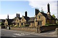
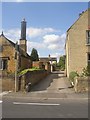
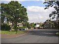
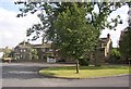
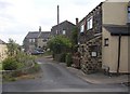
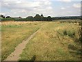
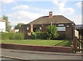
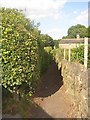
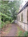
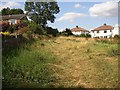
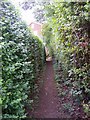
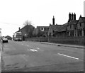
Photos of BD19 6DW
Area Information
Living in BD19 6DW means inhabiting a small, densely populated residential cluster in England’s West Yorkshire. With a population of 1,686 spread over just 1.02 km², this area is compact yet functional, reflecting a long history of industrial activity in the region. Situated in the Spen Valley, it is part of Cleckheaton, a town known for its textile manufacturing heritage. The area’s demographics suggest a mature, stable community: the median age is 47, with most residents aged 30–64. Daily life here is shaped by proximity to retail hubs like Co-op Scholes and Asda Wyke, as well as rail connections to nearby towns such as Halifax and Brighouse. While the area lacks major landmarks, its small size fosters a tight-knit feel, with residents relying on local services and community networks. The absence of significant natural or historical sites means the character of BD19 6DW is defined by its practicality and accessibility, making it suitable for those prioritising convenience over scenic appeal.
- Area Type
- Postcode
- Area Size
- Not available
- Population
- 1686
- Population Density
- 1660 people/km²
The property market in BD19 6DW is characterised by a high proportion of owner-occupied homes, with 58% of properties owned by residents rather than rented. This suggests a community of long-term residents, many of whom may have bought homes as investments or family residences. The accommodation type is predominantly houses, which is unusual for areas with high population density but aligns with the broader trend of suburban or semi-rural housing in the Spen Valley. This mix of ownership and housing stock implies a market that may appeal to buyers seeking stability, though the small size of the area means competition for properties is likely. For those considering the area, the focus on owner-occupied homes and the lack of rental availability could indicate limited options for tenants, but the presence of nearby towns like Halifax and Brighouse offers broader choices for those willing to commute.
House Prices in BD19 6DW
No properties found in this postcode.
Energy Efficiency in BD19 6DW
Residents of BD19 6DW have access to five retail venues within practical reach, including Co-op Scholes, Morrisons Daily Bradford, and Asda Wyke. These shops provide essential services, from groceries to general retail, supporting daily convenience. The area’s rail connectivity to stations like Brighouse and Halifax opens access to broader leisure and cultural opportunities in nearby towns. While specific parks or recreational spaces are not mentioned, the proximity to Cleckheaton—a town with listed buildings and historical sites—suggests potential for cultural exploration. The compact nature of the area means amenities are tightly clustered, reducing travel time for errands and socialising. This balance of local retail and regional transport links creates a lifestyle that prioritises accessibility and practicality, ideal for those who value efficiency in daily routines.
Amenities
Schools
The schools nearest to BD19 6DW include Hartshead Moor School, a special school, and Scholes Nursery School, a nursery. These institutions cater to a range of educational needs, from early childhood care to specialist education. The presence of a special school suggests the area may have a higher proportion of families with children requiring tailored support, while the nursery provides essential early education for younger children. However, the absence of primary or secondary schools in the immediate vicinity means families may need to travel to nearby towns for broader schooling. This could be a consideration for parents prioritising convenience, though the proximity to larger centres like Bradford and Halifax may offset this limitation. The mix of school types reflects the area’s role as a small residential hub within a larger educational network.
| Rank | School | Type | Entry gender | Ages |
|---|
Explore more schools in this area
Go to Schools tabDemographics
BD19 6DW has a median age of 47, with the majority of residents falling into the 30–64 age range. This suggests a community of established adults, many of whom may be in their prime working years or nearing retirement. Home ownership is strong here, with 58% of properties occupied by owners, compared to 42% rented. The accommodation type is predominantly houses, indicating a preference for single-family homes over flats or apartments. The predominant ethnic group is White, reflecting the broader demographic trends of the region. While no specific data on deprivation is provided, the high home ownership rate and age profile suggest a relatively stable, middle-income population. The absence of detailed diversity statistics means the area’s social composition remains largely unexplored in public records, though its proximity to Bradford and surrounding towns may introduce some cultural variety.
Household Size
Accommodation Type
Tenure
Ethnic Group
Religion
Household Composition
Age
Household Deprivation
NS-SEC
Explore more demographic insights in this area
Go to Demographics tabPlanning
Planning Constraints
- Flood RiskPremium
- Ramsar Wetland SitesPremium
- Area of Outstanding Natural BeautyPremium
- Protected Nature ReservePremium
- Protected WoodlandPremium