Area Overview for BD19 5YS
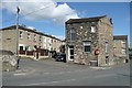
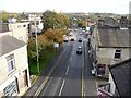
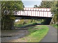
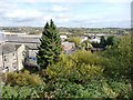
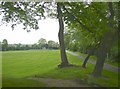
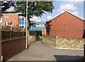
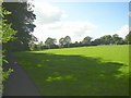
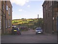
Photos of BD19 5YS
Area Information
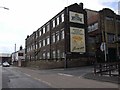
Living in BD19 5YS means being part of a small, tightly knit residential cluster in Cleckheaton, West Yorkshire. With a population of 2,165, the area retains a quiet, community-oriented character rooted in its historical textile manufacturing heritage. Situated at the heart of the Spen Valley, it is flanked by towns like Bradford, Brighouse, and Batley, offering proximity to larger urban centres while maintaining a rural feel. The area’s compact size means daily life is shaped by close-knit neighbourhoods and a slower pace, though it is within reach of transport links to nearby cities. The presence of listed buildings and historic sites, such as St John the Evangelist church, adds a layer of cultural richness. For those seeking a balance between tradition and modernity, BD19 5YS offers a stable environment with practical amenities, though its small scale means residents often look beyond the immediate area for specialist services.
- Area Type
- Postcode
- Area Size
- Not available
- Population
- Not available
- Population Density
- Not available
The property market in BD19 5YS is dominated by owner-occupied homes, with 60% of residents living in their own properties. The prevalence of houses over flats suggests a focus on family-friendly, spacious housing, which may appeal to buyers seeking stability and privacy. As a small, residential cluster, the area’s housing stock is likely limited in scale, meaning buyers may need to consider nearby towns for a broader range of options. The high home ownership rate indicates a community with long-term residents, which can be a draw for those prioritising a settled environment. However, the small size of the area means competition for properties could be intense, and buyers should be mindful of the limited scope for new developments.
House Prices in BD19 5YS
No properties found in this postcode.
Energy Efficiency in BD19 5YS
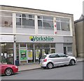
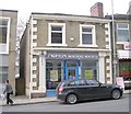
Residents of BD19 5YS have access to a range of practical amenities within reach, including five retail venues such as Heron Cleckheaton, Tesco Cleckheaton, and Morrisons Daily, ensuring everyday shopping needs are met. The area’s rail connections to Low Moor, Brighouse, and Mirfield provide links to nearby towns, though direct local services are absent. While the small scale of the area means leisure options are limited, the presence of retail hubs and transport links suggests a functional lifestyle focused on convenience. The quiet, residential character of BD19 5YS complements these amenities, offering a balance between practicality and a low-key, community-focused environment.
Amenities
Schools
The nearest school to BD19 5YS is Howard Park Community School, a primary institution with a good Ofsted rating. This provides families with a reliable option for early education, though the absence of secondary schools in the immediate area means students may need to travel to nearby towns for further education. The presence of a well-rated primary school is a key factor for families prioritising local schooling, but the lack of secondary provision could be a limitation for those requiring a full range of educational facilities. Parents should consider proximity to secondary schools in surrounding areas when planning for long-term needs.
| Rank | School | Type | Entry gender | Ages |
|---|
Explore more schools in this area
Go to Schools tabDemographics
The population of BD19 5YS is predominantly adults aged 30–64, with a median age of 47, reflecting a mature, established community. Home ownership stands at 60%, indicating a mix of long-term residents and families seeking stability. The area is characterised by houses rather than flats, suggesting a preference for larger, more private living spaces. The predominant ethnic group is White, though specific data on diversity beyond this is not provided. The age profile suggests a community with a strong presence of middle-aged individuals, potentially including retirees and families with school-aged children. This demographic aligns with the area’s practical amenities and proximity to local schools, though the absence of detailed deprivation metrics means it is unclear how economic pressures might affect quality of life for lower-income households.
Household Size
Accommodation Type
Tenure
Ethnic Group
Religion
Household Composition
Age
Household Deprivation
NS-SEC
Explore more demographic insights in this area
Go to Demographics tabPlanning
Planning Constraints
- Flood RiskPremium
- Ramsar Wetland SitesPremium
- Area of Outstanding Natural BeautyPremium
- Protected Nature ReservePremium
- Protected WoodlandPremium