Area Overview for BD19 4BQ
Photos of BD19 4BQ
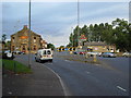
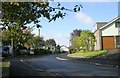
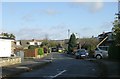
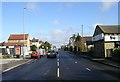
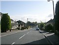
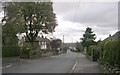
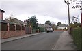
100 photos from this area
Area Information
Key information about the BD19 4BQ including its size, population, and administrative classification.
- Area Type
- Postcode
- Area Size
- 1.6 hectares
- Population
- 1684
- Population Density
- 1248 people/km²
House Prices in BD19 4BQ
19
Properties
£297,650
Average Sold Price
£83,500
Lowest Price
£630,000
Highest Price
Showing 19 properties
| Address | Type | Beds | Baths | Last Sale Price | Last Sale Date | |
|---|---|---|---|---|---|---|
| 391 Bradford Road, Birkenshaw, Bradford, BD19 4BQ | Detached | 5 | 3 | £630,000 | Jun 2025 | |
| 387 Bradford Road, Birkenshaw, Bradford, BD19 4BQ | Detached | 5 | 3 | £405,000 | May 2020 | |
| 389 Bradford Road, Birkenshaw, Bradford, BD19 4BQ | Detached | 5 | 3 | £373,000 | Jun 2019 | |
| 403 Bradford Road, Birkenshaw, Bradford, BD19 4BQ | house | - | - | £325,000 | Jul 2018 | |
| 385 Bradford Road, Birkenshaw, Bradford, BD19 4BQ | Detached | 4 | - | £346,000 | Aug 2014 | |
| 383 Bradford Road, Birkenshaw, Bradford, BD19 4BQ | house | - | - | £348,000 | Mar 2004 | |
| 393 Bradford Road, Birkenshaw, Bradford, BD19 4BQ | Detached | - | - | £83,500 | Apr 2001 | |
| 411 Bradford Road, Birkenshaw, Bradford, BD19 4BQ | Detached | - | - | £175,000 | Jul 1999 | |
| 405 Bradford Road, Birkenshaw, Bradford, BD19 4BQ | Detached | - | - | £145,000 | Jun 1999 | |
| 407 Bradford Road, Birkenshaw, Bradford, BD19 4BQ | Detached | - | - | £146,000 | May 1999 |
Page 1 of 2
Energy Efficiency in BD19 4BQ
Amenities
Schools
| Rank | School | Type | Entry gender | Ages |
|---|
Explore more schools in this area
Go to Schools tabDemographics
Household Size
Two person
most common
Accommodation Type
Houses
most common
Tenure
82
majority
Ethnic Group
White
most common
Religion
N/A
most common
Household Composition
N/A
most common
Age
47
median
Adults (30-64 years)
most common
Household Deprivation
N/A
with no deprivation
NS-SEC
41
in Lower managerial occupations
Explore more demographic insights in this area
Go to Demographics tabPlanning
Planning Constraints
- Flood RiskPremium
- Ramsar Wetland SitesPremium
- Area of Outstanding Natural BeautyPremium
- Protected Nature ReservePremium
- Protected WoodlandPremium