Area Overview for BD19 3DX
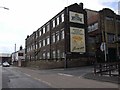
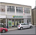
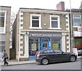
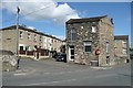
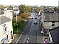
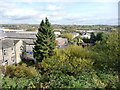
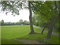
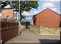
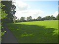
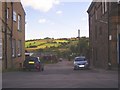
Photos of BD19 3DX
Area Information
Living in BD19 3DX means inhabiting a tightly packed residential cluster in the heart of Cleckheaton, West Yorkshire. The area covers just 2,778 square metres, housing 1,619 residents in a population density of over 582,000 people per square kilometre. This compact footprint reflects a long history as part of the Heavy Woollen District, where textile manufacturing once defined the local economy. Today, the area retains a quiet, community-focused character, with homes predominantly in private ownership. Its location in the Spen Valley offers proximity to nearby towns like Bradford and Leeds, yet it remains a self-contained enclave. Daily life here is shaped by the surrounding industrial heritage, with a focus on local amenities and schools. The high population density means a close-knit community, though the small area limits expansion. For those seeking a blend of historical roots and modern convenience, BD19 3DX offers a snapshot of a town still rooted in its past but adapting to contemporary needs.
- Area Type
- Postcode
- Area Size
- 2778 m²
- Population
- 1619
- Population Density
- 3235 people/km²
The property market in BD19 3DX is dominated by owner-occupied homes, with 69% of residents living in houses rather than flats. This suggests a focus on traditional, family-sized properties, likely with gardens and more space than the average urban dwelling. The high home ownership rate indicates limited rental activity, making the area less attractive to investors seeking turnover. However, the small size of the postcode area means housing stock is constrained, which could lead to competition among buyers. For those seeking a home in this cluster, the emphasis on houses implies a preference for privacy and space, though the compact nature of the area may limit availability. Prospective buyers should consider the limited scope for expansion and the potential for a tight market, particularly for properties aligned with the local demographic of middle-aged, long-term residents.
House Prices in BD19 3DX
No properties found in this postcode.
Energy Efficiency in BD19 3DX
Residents of BD19 3DX have access to a modest range of amenities within practical reach. Retail options include Tesco Cleckheaton, Heron Cleckheaton, and Spar Cleckheaton, providing essentials for daily life. The area’s rail connectivity, while limited to nearby stations like Low Moor and Brighouse, offers links to broader networks. The compact nature of the postcode means amenities are concentrated, with no mention of parks or leisure facilities in the data. However, the presence of multiple schools and shops suggests a community-oriented lifestyle, where local institutions and retail hubs form the backbone of daily activity. While the area may lack expansive green spaces or entertainment venues, its proximity to Cleckheaton’s historical and industrial heritage could offer cultural or historical interests for residents.
Amenities
Schools
Residents of BD19 3DX have access to several primary schools, including Heaton Avenue Primary School, West End Middle School, and Whitcliffe Mount School. Among these, Heaton Avenue, A Share Primary Academy holds a satisfactory Ofsted rating, while Whitcliffe Mount, A Share Academy is an academy. The presence of multiple primary schools suggests a focus on early education, though the absence of secondary schools means families may need to look further afield for high school options. The mix of traditional schools and academies offers varied approaches to teaching, but the lack of specific data on academic performance or pupil outcomes means parents must rely on Ofsted ratings and school names to gauge quality. For families prioritising proximity to schools, the cluster of primary institutions provides convenience, though the absence of secondary education within the area is a notable consideration.
| Rank | School | Type | Entry gender | Ages |
|---|
Explore more schools in this area
Go to Schools tabDemographics
BD19 3DX is home to 1,619 residents, with a median age of 47, indicating a mature population skewed towards adults aged 30–64. Home ownership is high at 69%, with most residents living in houses rather than flats. The predominant ethnic group is White, reflecting the area’s historical demographic patterns. The age profile suggests a stable, family-oriented community, though the absence of specific data on younger demographics or diversity metrics means the full picture of social composition remains incomplete. The high home ownership rate implies long-term residency for many, with properties likely to be family homes rather than short-term rentals. This demographic structure supports a quiet, established neighbourhood, where local institutions like schools and shops play a central role in daily life.
Household Size
Accommodation Type
Tenure
Ethnic Group
Religion
Household Composition
Age
Household Deprivation
NS-SEC
Explore more demographic insights in this area
Go to Demographics tabPlanning
Planning Constraints
- Flood RiskPremium
- Ramsar Wetland SitesPremium
- Area of Outstanding Natural BeautyPremium
- Protected Nature ReservePremium
- Protected WoodlandPremium