Area Overview for BD17 6UY
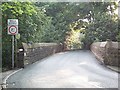
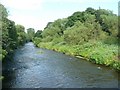
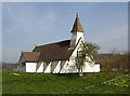
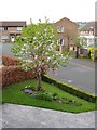
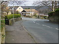
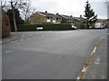
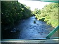
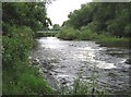
Photos of BD17 6UY
Area Information
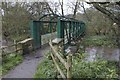
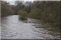
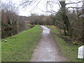
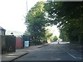
Living in BD17 6UY means residing within a specific residential cluster that defines the community of Baildon in West Yorkshire. This small settlement lies on Baildon Moor, positioned above the River Aire near the larger hubs of Bradford and Shipley. The area's heart has evolved from ancient farming roots and 18th-century textile industry sites into a modern commuter town. Historical records show the location as *Beldone* in the 1086 Domesday Book, noting its long-standing significance before modern urban district status was granted in 1894. Today, the immediate vicinity of this postcode retains a picturesque Yorkshire countryside atmosphere with dramatic scenery and unpolluted air. Residents enjoy a blend of historic charm and contemporary convenience, situated among prehistoric cup-and-ring marked stones and other scheduled monuments on the nearby moors. The property search for this specific postcode focuses on a tight-knit neighbourhood where daily life balances suburban retirement properties with the tranquil edge of the natural landscape. This environment appeals to those seeking a quieter existence while remaining connected to the wider transport network of the Humber region.
- Area Type
- Postcode
- Area Size
- Not available
- Population
- 1406
- Population Density
- 2665 people/km²
Buying a home in BD17 6UY focuses on a market characterised by traditional houses and high stability. The accommodation type is overwhelmingly Houses, meaning buyers should expect to find properties suited for families or those requiring garden space. A striking 78% of residents are homeowners, which signals that the local housing stock consists largely of owner-occupied homes rather than rental properties. This concentration of owners suggests that prices in this specific postcode are driven by long-term residents looking to stay or upgrade. Because this is a small residential cluster with a population of just over 1,400, the range of property sizes will be limited compared to larger suburbs. The high ownership rate implies that moving here often involves purchasing an existing home rather than renting. For buyers looking at the wider Baildon area, these figures reinforce a sense of permanence and community investment. The absence of large-scale rental blocks or student housing units creates a distinct market niche. Those interested in this postcode will find a sanctuary for those who value ownership and the classic English estate feel.
House Prices in BD17 6UY
No properties found in this postcode.
Energy Efficiency in BD17 6UY
Residents of BD17 6UY enjoy a range of practical amenities within easy reach for daily shopping and travel. For retail needs, shops such as Co-op Baildon, Morrisons Daily, and Tesco Baildon are located in the immediate surroundings to cover all grocery requirements. The area offers practical access to five railway stations, including Baildon Railway Station, Shipley Railway Station, and Saltaire Railway Station, facilitating easy trips to Bradford or Leeds. Commuters can also utilise connections to Leeds Bradford Airport and Leeds Bradford International Airport for international travel. These transport links support the area's function as a commuter town while maintaining local independence. The presence of these specific venues means that residents rarely struggle to find essential services or train connections. Daily life combines the convenience of high-street shopping with the option of rail travel for work or leisure. The specific naming of these stations and supermarkets grounds the lifestyle in tangible, accessible locations rather than abstract concepts of "local options".
Amenities
Schools
Families living near BD17 6UY have access to three specific schools, all offering primary education. Baildon CofE Primary School is located in the neighbourhood and caters to younger children as a primary institution. Nearby, Ladderbanks Middle School also serves as a primary school for the local community. Of crucial importance for parents is Baildon Church of England Primary School, which holds an outstanding Ofsted rating. This top-tier rating provides strong reassurance regarding the educational quality available within immediate reach of the postcode. The presence of multiple primary schools indicates that early education is well-supported locally. This mix ensures that children do not need to travel far to begin their learning journey. The outstanding rating at Baildon Church of England Primary School sets a high standard for the immediate vicinity. Families should consider these three options when evaluating the educational environment for their children. The concentration of primary education facilities supports the area's dominance by households with young children, aligning with the demographic profile of adults aged 30 to 64.
| Rank | School | Type | Entry gender | Ages |
|---|
Explore more schools in this area
Go to Schools tabDemographics
The community in BD17 6UY is defined by a stable, established population of 1,406 people. The median age is 47 years, indicating that adults between the ages of 30 and 64 make up the most common age range. This demographic profile suggests a neighbourhood dominated by families and professionals rather than young students or retirees. Home ownership stands at a high level of 78%, confirming that the vast majority of residents own their properties outright. The accommodation type is exclusively Houses, with no apartments or flats recorded for this specific postcode. The predominant ethnic group is White, reflecting the traditional character of this West Yorkshire settlement. These straight facts indicate a settled community with a clear preference for detached or semi-detached family homes. The high ownership rate and mature age profile imply a stable environment where long-term residents dominate. There are very few younger households, which means the local social fabric relies heavily on established families. This demographic makes for a quiet, predictable living environment where neighbours likely know one another well. The lack of young people under 30 suggests that new families are drawn here from outside the area as they seek stability and space.
Household Size
Accommodation Type
Tenure
Ethnic Group
Religion
Household Composition
Age
Household Deprivation
NS-SEC
Explore more demographic insights in this area
Go to Demographics tabPlanning
Planning Constraints
- Flood RiskPremium
- Ramsar Wetland SitesPremium
- Area of Outstanding Natural BeautyPremium
- Protected Nature ReservePremium
- Protected WoodlandPremium