Area Overview for BD17 6TF
Photos of BD17 6TF
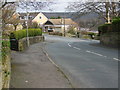
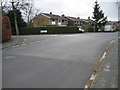
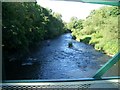
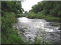
100 photos from this area
Area Information
Key information about the BD17 6TF including its size, population, and administrative classification.
- Area Type
- Postcode
- Area Size
- 9251 m²
- Population
- 1516
- Population Density
- 2812 people/km²
House Prices in BD17 6TF
14
Properties
£169,915
Average Sold Price
£94,950
Lowest Price
£247,500
Highest Price
Showing 14 properties
| Address | Type | Beds | Baths | Last Sale Price | Last Sale Date | |
|---|---|---|---|---|---|---|
| 3 Littondale Close, Baildon, BD17 6TF | Semi-detached | 3 | 2 | £247,500 | Mar 2024 | |
| 25 Littondale Close, Baildon, BD17 6TF | Bungalow | 2 | 1 | £171,950 | Dec 2021 | |
| 23 Littondale Close, Baildon, BD17 6TF | Bungalow | 2 | 1 | £188,950 | Aug 2021 | |
| 1 Littondale Close, Baildon, BD17 6TF | Semi-detached | 3 | 1 | £205,000 | Nov 2020 | |
| 11 Littondale Close, Baildon, BD17 6TF | house | - | - | £193,000 | Nov 2020 | |
| 9 Littondale Close, Baildon, BD17 6TF | Semi-detached | 3 | 1 | £205,000 | Oct 2020 | |
| 13 Littondale Close, Baildon, BD17 6TF | house | - | - | £190,000 | Nov 2017 | |
| 21 Littondale Close, Baildon, BD17 6TF | Bungalow | - | - | £145,000 | Sep 2014 | |
| 27 Littondale Close, Baildon, BD17 6TF | Bungalow | - | - | £153,000 | Jun 2014 | |
| 7 Littondale Close, Baildon, BD17 6TF | Semi-detached | 3 | 1 | £144,550 | Mar 2013 |
Page 1 of 2
Energy Efficiency in BD17 6TF
Amenities
Schools
| Rank | School | Type | Entry gender | Ages |
|---|
Explore more schools in this area
Go to Schools tabDemographics
Household Size
Two person
most common
Accommodation Type
Houses
most common
Tenure
84
majority
Ethnic Group
White
most common
Religion
N/A
most common
Household Composition
N/A
most common
Age
47
median
Adults (30-64 years)
most common
Household Deprivation
N/A
with no deprivation
NS-SEC
44
in Lower managerial occupations
Explore more demographic insights in this area
Go to Demographics tabPlanning
Planning Constraints
- Flood RiskPremium
- Ramsar Wetland SitesPremium
- Area of Outstanding Natural BeautyPremium
- Protected Nature ReservePremium
- Protected WoodlandPremium