Area Overview for BD17 6SY
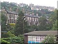
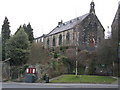
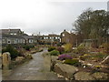
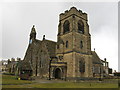
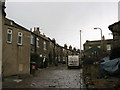
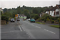
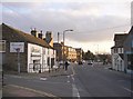
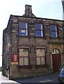
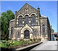
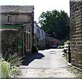
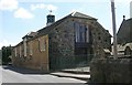
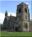
Photos of BD17 6SY
Area Information
Bordering the historic Baildon Moor, BD17 6SY represents a specific residential cluster defined by a deep sense of place. This postcode sits within a settlement that evolved from prehistoric activity to a commuter town, now retaining rural edges amidst modern developments. The area covers 4933 square metres and supports a population of 1406 residents, creating a tightly knit environment where neighbours are often familiar faces. Life here balances the quiet charm of a Yorkshire countryside atmosphere with straightforward access to wider networks. You live above the River Aire within the City of Bradford district, benefiting from unpolluted air and dramatic scenery that those seeking a retreat appreciate. The community functions as a suburban holiday home for many, blending historic character with practical conveniences. Ancient roots run through the land, with physical evidence of Iron Age settlements and Neolithic artefacts nearby. Today, the area maintains its identity as a desirable retreat without sacrificing connectivity. The atmosphere is distinct from the bustling city centre, offering a slower pace while remaining only minutes away from larger urban hubs. Families and commuters value the stability this location provides, anchored by the reliable transport links and the preserved natural features surrounding the housing cluster. When you consider living in BD17 6SY, you gain access to a community that honours its history while serving contemporary household needs. The area remains small enough to know everyone yet connected enough to reach Leeds or Bradford with ease.
- Area Type
- Postcode
- Area Size
- 4933 m²
- Population
- 1406
- Population Density
- 2665 people/km²
The housing stock in BD17 6SY is characterised by a clear dominance of residential houses, reflecting the area's evolution from an agricultural village to a suburban settlement. With a 78% home ownership rate, the local market is overwhelmingly owner-occupied rather than rental-driven. This statistic confirms that most properties are settled homes, likely passed down or purchased for long-term residence. You will find that accommodation types here are almost exclusively houses, fitting the preference for detached or semi-detached buildings common in this section of the City of Bradford district. The small size of the postcode area, covering just 4933 square metres, limits the variety of developments to small, established clusters rather than large-scale estates or urban apartments. For buyers, the high ownership rate suggests a market where properties have remained in the same families for generations. This stability often correlates with well-maintained streets and a quiet residential atmosphere. Unlike areas saturated with student housing or temporary lets, BD17 6SY presents a consistent picture of established ownership. The prevalence of houses aligns with the demographic profile, where adults in the 30-64 age group seek family-friendly environments. When you look at homes in BD17 6SY, you are purchasing into a stock defined by permanence. The lack of rental dominance means neighbourhood standards tend to reflect long-term investment rather than short-term turnover. This makes the area attractive for those prioritising stability over rapid market fluctuations.
House Prices in BD17 6SY
Showing 7 properties
| Address | Type | Beds | Baths | Last Sale Price | Last Sale Date | |
|---|---|---|---|---|---|---|
| 4 Grafton Close, Baildon, BD17 6SY | Bungalow | 3 | 1 | £425,000 | Nov 2023 | |
| 3 Grafton Close, Baildon, BD17 6SY | Bungalow | - | - | £376,500 | Mar 2021 | |
| 5 Grafton Close, Baildon, BD17 6SY | house | - | - | £335,000 | Jan 2018 | |
| 6 Grafton Close, Baildon, BD17 6SY | Bungalow | - | - | £247,500 | Feb 2013 | |
| 2 Grafton Close, Baildon, BD17 6SY | Detached | - | - | £120,000 | Apr 1998 | |
| 8 Grafton Close, Baildon, BD17 6SY | Detached | - | - | - | - | |
| 1 Grafton Close, Baildon, BD17 6SY | Detached | - | - | - | - |
Energy Efficiency in BD17 6SY
Residents of BD17 6SY enjoy a lifestyle that blends local convenience with regional accessibility. Five retail outlets operate within practical reach, including Co-op Baildon, Morrisons Daily, and Tesco Baildon. These supermarkets meet weekly shopping needs without requiring a long journey into the town centre. Transport options are equally diverse, with five railway stations nearby including Baildon Railway Station, Shipley Railway Station, and Saltaire Railway Station. Commuters can choose from these nodes depending on their destination or timetable. Air travel is feasible for occasional trips, as Leeds Bradford Airport and Leeds Bradford International Airport serve the region with two nearby options. This proximity allows residents to reach national destinations quickly when needed. The area surrounds itself with Baildon Moor, offering prehistoric landscape and scheduled monuments that provide leisure opportunities. You can explore historic sites like Ian Clough Hall or walk among Neolithic artefacts along the moorland edges. The lifestyle here is defined by these amenities sitting close to hand, ensuring that daily chores and cultural interests do not compete for your time. Living in BD17 6SY means you have your essentials easily accessible while retaining the ability to explore broader leisure options when you choose to leave the immediate neighbourhood.
Amenities
Schools
Families considering BD17 6SY benefit from access to three specific educational institutions within practical reach. Baildon Church of England Primary School offers primary education with an outstanding Ofsted rating, providing a high standard of care and instruction for younger children. Baildon CofE Primary School serves as another key option for families, though the specific Ofsted grading for this institution is not detailed in the current records. Ladderbanks Middle School provides primary-level education for children requiring a larger school environment or specific middle-phase curriculum support. The presence of multiple primary schools nearby indicates a well-serviced catchment area for infants and juniors. The inclusion of an outstanding-rated school highlights a focus on quality education in the immediate vicinity. While Ladderbanks is listed as a primary school in the data, its inclusion alongside two other primary options suggests that the area caters specifically to young children before they transition to secondary education further afield. For those living in BD17 6SY, the educational infrastructure is characterised by Church of England sponsorship and dedicated primary facilities. The mix of school types, including the highly rated CofE option, ensures that parents have access to institutions with recognised quality standards. This arrangement supports the area's demographic of adults in the 30-64 age group who require reliable schooling for their families.
| Rank | School | Type | Entry gender | Ages |
|---|
Explore more schools in this area
Go to Schools tabDemographics
The community in BD17 6SY reflects a stable, mature demographic profile suitable for long-term family living. Adults aged 30 to 64 years form the most common age range, indicating a population established enough to own homes but young enough to maintain active lifestyles. The median age stands at 47, suggesting that this neighbourhood attracts households who have already secured their financial footing. A significant majority of residents own their properties outright, with a 78% home ownership rate that defines the local character. This high level of ownership correlates with the fact that houses dominate the accommodation type landscape, distinguishing it from rental-heavy urban centres. Residents identify primarily as White, fitting the broader demographic profile of the West Riding of Yorkshire. The stability shown through high ownership rates and a mature age profile means you can expect a community where roots are deep. This demographic structure supports local schools and community groups, as adults in the 30-64 bracket often bring children into the area as they grow older. The absence of transient housing aligns with the large proportion of owner-occupied homes, creating a consistent cultural environment. When looking at homes in BD17 6SY, the social fabric mirrors the physical stock, built on ownership and longevity. This demographic reality offers a predictable living environment where values tend to be traditional and community-focused.
Household Size
Accommodation Type
Tenure
Ethnic Group
Religion
Household Composition
Age
Household Deprivation
NS-SEC
Explore more demographic insights in this area
Go to Demographics tabPlanning
Planning Constraints
- Flood RiskPremium
- Ramsar Wetland SitesPremium
- Area of Outstanding Natural BeautyPremium
- Protected Nature ReservePremium
- Protected WoodlandPremium