Area Overview for BD16 1JF
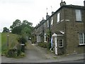
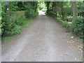
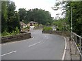
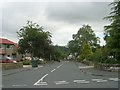
Photos of BD16 1JF
Area Information
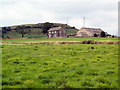
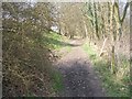
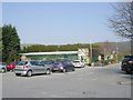
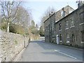
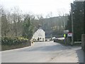
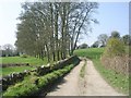
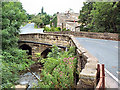
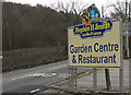
Living in BD16 1JF offers a distinctly rural experience within the City of Bradford Metropolitan District. This civil parish cluster spans 9,456 square metres and supports a population of 1,602 people. The area sits in Airedale, approximately two miles west of Bingley, creating a setting defined by farming landscapes and original farmsteads. You will find clusters of buildings situated in a valley drained by Harden Beck, reflecting settlement patterns dating back thousands of years. Historical records indicate Bronze Age burial mounds and Roman roads once crossed this land, providing a deep sense of history beneath modern feet. The village character remains rooted in its agricultural past, with no new large-scale developments altering this established layout. Residents here enjoy a low-density environment where quiet living takes precedence. The postcodes in this specific cluster sit near notable features such as Harden Moor, which hosts Bronze Age cairns and Roman remains. While the area lacks major industrial zones, it benefits from proximity to nearby market towns for broader services. This location suits those prioritising quiet countryside living over urban amenities. You can walk or cycle to local green spaces including Leeds and Laswells Gorge nature reserves as part of the wider Beck with Roke conservation area. The community feels intimate, with a population density of 1,470 people per square kilometre ensuring you know your neighbours in this small residential grouping.
- Area Type
- Postcode
- Area Size
- 9456 m²
- Population
- 1602
- Population Density
- 1470 people/km²
House Prices in BD16 1JF
Showing 8 properties
| Address | Type | Beds | Baths | Last Sale Price | Last Sale Date | |
|---|---|---|---|---|---|---|
| Greenacres, Firbeck, Harden, Bingley, BD16 1JF | Detached | 4 | 3 | £460,000 | Sep 2019 | |
| Beck Cottage, Wilsden Old Road, Harden, Bingley, BD16 1JF | house | - | - | £385,000 | Mar 2017 | |
| Robinia, Wilsden Old Road, Harden, Bingley, BD16 1JF | Bungalow | 3 | 2 | £250,000 | Nov 2014 | |
| Kennicot, Wilsden Old Road, Harden, Bingley, BD16 1JF | Detached | - | - | £310,000 | May 2007 | |
| Braeside, Wilsden Old Road, Harden, Bingley, BD16 1JF | Detached | 4 | 3 | - | - | |
| Glenview, Wilsden Old Road, Harden, Bingley, BD16 1JF | Detached | - | - | - | - | |
| Two Ways, Wilsden Old Road, Harden, Bingley, BD16 1JF | Detached | - | - | - | - | |
| Sunnyview, Wilsden Old Road, Harden, Bingley, BD16 1JF | Detached | - | - | - | - |
Energy Efficiency in BD16 1JF
Amenities
Schools
Families residing in BD16 1JF benefit from access to local education providers within the village and nearby settlements. Harden Primary School stands as the key educational facility in your immediate area. Rated good by Ofsted, this institution serves younger children living in the parish. The school caters to the demographic of 86% who are homeowners with children, ensuring a stable intake of students. No secondary schools are listed directly within the very specific BD16 1JF cluster, meaning older pupils must travel to larger towns such as Keighley or Bingley for their education. This arrangement reflects the rural nature of the village, where age-specific infrastructure is managed through regional collaboration. Parents enrolling children at Harden Primary School can expect a strong local focus on community values. The school's affirmative Ofsted rating indicates it meets national standards for curriculum and safety. Older children may rely on a school bus service or cycle routes connecting the village to nearby market towns. The mix of school types is limited here, with primary education being the main provision for residents under 11 years old. For homebuyers prioritising education, the proximity to Harden Primary School is a significant advantage, especially given the rural character which often supports higher student-teacher ratios.
| Rank | School | Type | Entry gender | Ages |
|---|
Explore more schools in this area
Go to Schools tabDemographics
Household Size
Accommodation Type
Tenure
Ethnic Group
Religion
Household Composition
Age
Household Deprivation
NS-SEC
Explore more demographic insights in this area
Go to Demographics tabPlanning
Planning Constraints
- Flood RiskPremium
- Ramsar Wetland SitesPremium
- Area of Outstanding Natural BeautyPremium
- Protected Nature ReservePremium
- Protected WoodlandPremium