Area Overview for BD16 1AT
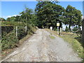
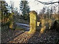
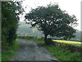
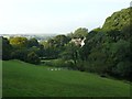
Photos of BD16 1AT
Area Information
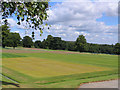
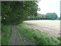
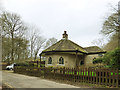
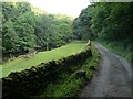
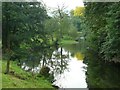
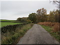
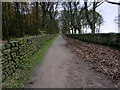
Living in BD16 1AT offers a residence within a small residential cluster that spans just 1.1 km². This specific postcode area sits within the wider civil parish of Harden in the City of Bradford Metropolitan District, West Yorkshire. The population here totals 1,604 residents, creating a tight-knit community with a density of 237 people per square kilometre. The area blends rural characteristics with the proximity of the market town of Bingley, located approximately two miles away. Historical records indicate this location was first documented in the Domesday Book of 1086, once part of Bingley manor. The landscape remains defined by original farmsteads and a valley drained by Harden Beck, reflecting centuries of farming and settlement patterns. Residences here offer a connection to local history, situated near notable features such as Harden Moor and the historic St Ives Estate. Daily life balances the quiet of a village setting with access to broader services, making it suitable for those seeking a home grounded in history and local distinctiveness.
- Area Type
- Postcode
- Area Size
- 1.1 km²
- Population
- 1604
- Population Density
- 237 people/km²
The property market in BD16 1AT is characterised primarily by owner-occupation rather than a rental market. With 68 percent of homes in this postcode being owner-occupied, you are likely to find significant stability within the local housing stock. The accommodation type is exclusively houses, meaning buyers will not encounter flats or apartments within this specific cluster. This contrasts with larger urban centres where diverse housing types coexist. The total of 1604 residents across 1.1 km² suggests limited space for new large-scale developments, which maintains the area's village character. Prospective buyers should expect to encounter traditional homes that have evolved alongside the local landscape since the Roman occupation. The history of mills along Harden Beck and the later industrial presence of Ellison Circlips has shaped the existing housing fabric. Consequently, the market focuses on purchasing established properties within a protected, low-density environment, rather than seeking new-build apartments or high-density estate developments.
House Prices in BD16 1AT
Showing 18 properties
| Address | Type | Beds | Baths | Last Sale Price | Last Sale Date | |
|---|---|---|---|---|---|---|
| 1, Golf Cottages, Cross Gates Lane, Harden, Bingley, BD16 1AT | house | - | - | £271,000 | Aug 2022 | |
| 2, Golf Cottages, Cross Gates Lane, Harden, Bingley, BD16 1AT | Semi-detached | - | - | £87,500 | Sep 2002 | |
| 3 The Cottage, St Ives Estate, Keighley Road, Harden, Bingley, BD16 1AT | Terraced | 2 | 1 | - | - | |
| Home Farm, St Ives Estate, Keighley Road, Harden, Bingley, BD16 1AT | Cottage | 2 | 1 | - | - | |
| 1 The Cottage, St Ives Estate, Keighley Road, Harden, Bingley, BD16 1AT | Cottage | 2 | 1 | - | - | |
| 2 The Cottage, St Ives Estate, Keighley Road, Harden, Bingley, BD16 1AT | Retail | 2 | 1 | - | - | |
| 6 The Cottage, St Ives Estate, Keighley Road, Harden, Bingley, BD16 1AT | house | - | - | - | - | |
| 5 The Cottage, St Ives Estate, Keighley Road, Harden, Bingley, BD16 1AT | house | - | - | - | - | |
| 4 The Cottage, St Ives Estate, Keighley Road, Harden, Bingley, BD16 1AT | house | - | - | - | - | |
| The Coach House, St Ives Estate, Keighley Road, Harden, Bingley, BD16 1AT | Office | - | - | - | - |
Energy Efficiency in BD16 1AT
Residents of BD16 1AT benefit from practical access to retail, rail, and leisure amenities within reasonable reach. Five notable retail locations operate nearby, including M&S Rankin Bingley BP, Lidl Thrift, and Co-op Bingley 5. These venues provide everyday shopping necessities for the local population. Rail connectivity is supported by five stations in the vicinity, featuring Crossflatts Railway Station, Bingley Railway Station, and Keighley Railway Station. For bus travel, services link directly to Ingrow West, Damems, and Oakworth. Beyond shopping, the area is defined by Harden Moor, which serves as a leisure area containing Bronze Age cairns and Druids Altar. The former site of Ellison Circlips has been redeveloped, adding to the local character. The village church and war memorial on a Tuscan sandstone column add to the cultural points of interest. You can walk the Roman roads that historically crossed the landscape, connecting your daily life with over 1,600 years of local history while accessing modern shops and transport nodes.
Amenities
Schools
Families living in BD16 1AT are supported by a specific selection of educational establishments in the immediate vicinity. The nearest primary option is Bingley CofE First School, which serves the local neighbourhood. You can also look to Bingley Grammar School, a primary institution that holds a declared Ofsted rating of good. This school provides an accredited education standard for children attending the catchment area surrounding the postcode. The mix of school types includes both Church of England primary education and state-funded grammar education. While specific data on secondary schools is not listed for this immediate postcode, the presence of a rated primary school Bingley Grammar School indicates a baseline of educational quality nearby. Residents must verify transport links and catchment boundaries to ensure their children can access these specific schools. Both institutions are located in the broader Bingley area, which falls within the practical reach of residents in BD16 1AT.
| Rank | School | Type | Entry gender | Ages |
|---|
Explore more schools in this area
Go to Schools tabDemographics
The community in BD16 1AT is mature, with a median age of 47 years. The most common age range comprises adults aged between 30 and 64 years, indicating a stable workforce and established families or individuals. Home ownership is the dominant form of tenure, with 68 percent of residents owning their properties outright or with a mortgage. The remaining 32 percent likely reside in rental accommodation. Nearly all housing stock consists of houses, a direct reflection of the area's historic layout and the former presence of mills and farms. The predominant ethnic group in the area is White, mirroring the broader demographic trends of the region. You will not find data suggesting significant deprivation; instead, the high home ownership rate points to financial stability among the population. This demographic profile suggests a neighbourhood where long-term residents maintain a strong connection to the village, rather than a high turnover of transient tenants or students.
Household Size
Accommodation Type
Tenure
Ethnic Group
Religion
Household Composition
Age
Household Deprivation
NS-SEC
Explore more demographic insights in this area
Go to Demographics tabPlanning
Planning Constraints
- Flood RiskPremium
- Ramsar Wetland SitesPremium
- Area of Outstanding Natural BeautyPremium
- Protected Nature ReservePremium
- Protected WoodlandPremium