Area Overview for BD15 7QG
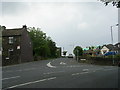
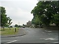
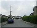
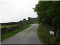
Photos of BD15 7QG

Area Information
BD15 7QG lies within the City of Bradford Metropolitan District Council in West Yorkshire, a small residential cluster with a population of 1833. This area is part of the Thornton and Allerton ward, historically shaped by 19th-century municipal expansions and industrial development. The postcode covers a mix of older and newer housing, with a focus on family-oriented living. Residents benefit from proximity to nearby towns like Saltaire and Frizinghall, offering a blend of local character and regional connectivity. The area’s heritage is evident in its listed buildings, including Grade I and II* structures, reflecting its historical significance as a former workhouse and industrial hub. Daily life here is defined by a quiet, community-driven rhythm, with local amenities and schools serving a population predominantly aged 30–64. While the area lacks the density of larger cities, its manageable size and low flood risk make it a practical choice for those seeking stability in a historic yet functional setting.
- Area Type
- Postcode
- Area Size
- Not available
- Population
- 1833
- Population Density
- 5590 people/km²
BD15 7QG’s property market is defined by its low home ownership rate of 29%, indicating a strong rental market. The area is composed primarily of houses rather than flats, suggesting a focus on family homes and traditional housing stock. This contrasts with larger urban areas where flats dominate, and may appeal to buyers seeking larger properties with gardens. However, the small size of the postcode area limits the availability of properties, meaning buyers must consider nearby regions for more options. The predominance of owner-occupied housing in surrounding areas may also influence local property values, though the low ownership rate here suggests limited speculation or investment activity. For buyers, this means a niche market with fewer choices but potentially stable, long-term housing options.
House Prices in BD15 7QG
No properties found in this postcode.
Energy Efficiency in BD15 7QG
The lifestyle in BD15 7QG is supported by nearby amenities including retail outlets like Heron Allerton, Aldi Allerton, and Morrisons Daily, ensuring convenience for shopping. Rail stations such as Frizinghall and Saltaire provide access to broader networks, while metro stops at Damems and Ingrow West connect to surrounding areas. Though specific parks or leisure facilities are not detailed, the area’s historical character and proximity to natural sites like the Airedale Valley suggest opportunities for outdoor activities. The presence of local shops and transport hubs fosters a self-sufficient, community-focused lifestyle, balancing practicality with the charm of a historic postcode.
Amenities
Schools
Near BD15 7QG are several primary schools, including Allerton Primary School, Ley Top Primary School (Ofsted rating: satisfactory), St Matthew’s Catholic Primary School, Allerton Middle School, and Beckfoot Allerton Primary School and Nursery (Ofsted rating: outstanding). The presence of both state and faith-based institutions offers families varied educational choices. Beckfoot Allerton’s outstanding rating highlights a high-performing option, while others provide more standard provision. The mix of school types ensures accessibility for different preferences, though the lack of secondary schools in the immediate area may require commuting. For families prioritising academic performance, Beckfoot Allerton stands out, while others may balance convenience with moderate ratings.
| Rank | School | Type | Entry gender | Ages |
|---|
Explore more schools in this area
Go to Schools tabDemographics
The population of BD15 7QG is 1833, with a median age of 47, indicating a mature demographic skewed toward adults aged 30–64. Home ownership here is notably low at 29%, suggesting a rental market dominance. The area is characterised by houses rather than flats, aligning with its traditional residential profile. The predominant ethnic group is White, reflecting broader trends in the region. This age group’s presence implies a community focused on long-term stability, though the low home ownership rate may indicate a transient population or reliance on rental housing. The absence of specific data on deprivation means quality of life factors like access to services and employment opportunities remain unquantified, but the presence of schools and transport links suggests basic needs are met.
Household Size
Accommodation Type
Tenure
Ethnic Group
Religion
Household Composition
Age
Household Deprivation
NS-SEC
Explore more demographic insights in this area
Go to Demographics tabPlanning
Planning Constraints
- Flood RiskPremium
- Ramsar Wetland SitesPremium
- Area of Outstanding Natural BeautyPremium
- Protected Nature ReservePremium
- Protected WoodlandPremium