Area Overview for BD15 7AF
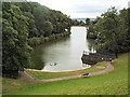
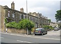
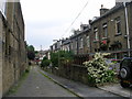
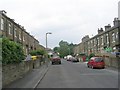
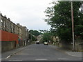
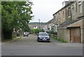
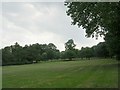
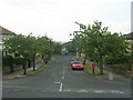
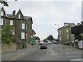
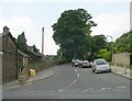
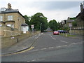
Photos of BD15 7AF

Area Information
BD15 7AF lies within the City of Bradford Metropolitan District Council in West Yorkshire, encompassing a small residential cluster with a population of 2023. The area covers 1030 square metres, translating to a population density of 1,963,926 people per square kilometre—a stark figure reflecting its compact nature. This postcode falls within the Thornton and Allerton ward, historically shaped by 19th-century municipal expansions and industrial developments. Daily life here is defined by its proximity to retail, rail, and metro networks, with shops like Morrisons Daily and Aldi Allerton within reach. The area’s character is rooted in its heritage: listed buildings, including Grade I and II* structures, line streets such as Firth Street and George Street. While modern amenities are present, the community retains a historical footprint, with remnants of 18th- and 19th-century infrastructure. This blend of compact living and preserved architecture makes BD15 7AF a niche location for those seeking proximity to transport hubs and a touch of historical significance.
- Area Type
- Postcode
- Area Size
- 1030 m²
- Population
- Not available
- Population Density
- Not available
The property market in BD15 7AF is dominated by owner-occupied homes, with 69% of residents owning their properties. This suggests a stable market where long-term residency is common. The accommodation type is exclusively houses, which is unusual for urban areas of this size and may indicate a focus on family homes or semi-detached properties. The small area size and high population density imply limited land for new developments, potentially driving competition among buyers. For those seeking a home, the predominance of owner-occupied housing could mean fewer rental options, though the proximity to rail and metro networks might offset this by offering strong connectivity to nearby towns. The historical presence of listed buildings and 19th-century infrastructure also adds character, though buyers should consider the compact nature of the area and its reliance on shared amenities.
House Prices in BD15 7AF
Showing 5 properties
| Address | Type | Beds | Baths | Last Sale Price | Last Sale Date | |
|---|---|---|---|---|---|---|
| Air Conditioning Solutions Limited, Prospect Works, 222 Allerton Road, Bradford, BD15 7AF | Office | - | - | - | - | |
| Yorkshire Displays Limited, Warehouse Ground Floor, Prospect Works, 222 Allerton Road, Bradford, BD15 7AF | warehouse | - | - | - | - | |
| Store Ground Floor, Prospect Works, Allerton Road, Bradford, BD15 7AF | warehouse | - | - | - | - | |
| Enviroclean Limited, The Gatehouse, Prospect Works, 222 Allerton Road, Bradford, BD15 7AF | warehouse | - | - | - | - | |
| Ground Floor Store, Prospect Works, 222 Allerton Road, Bradford, BD15 7AF | warehouse | - | - | - | - |
Energy Efficiency in BD15 7AF
Living in BD15 7AF offers access to a mix of retail, transport, and historical amenities. Nearby shops include Morrisons Daily, Aldi Allerton, and Heron Allerton, providing essential groceries and daily necessities. The area’s rail and metro connections—such as Frizinghall and Bradford Forster Square stations—facilitate quick travel to Bradford’s cultural and commercial hubs. Historically, the ward contains 135 listed buildings, including Kipping Chapel and remnants of 19th-century workhouses, adding a layer of heritage to everyday life. Streets like Firth Street and George Street, developed in the 1860s, reflect the area’s industrial past. While the compact size limits green spaces, the proximity to transport and retail ensures convenience. The blend of historical sites and modern amenities creates a distinctive character, appealing to those who value both heritage and practicality in their daily routines.
Amenities
Schools
| Rank | School | Type | Entry gender | Ages |
|---|
Explore more schools in this area
Go to Schools tabDemographics
The population of BD15 7AF has a median age of 47, with the majority of residents falling within the 30-64 age range. Home ownership is high at 69%, indicating a stable, long-term community. The accommodation type is predominantly houses, suggesting a family-oriented demographic. The predominant ethnic group is Asian, reflecting broader trends in Bradford’s multicultural fabric. The area’s population density—1,963,926 people per square kilometre—implies a tightly packed residential environment, which may influence local services and social dynamics. While no specific deprivation data is provided, the high home ownership rate and historical presence of workhouses suggest a community with established roots. The age profile and ownership figures point to a mature, settled population, though the lack of specific diversity metrics beyond the Asian majority leaves gaps in understanding the full demographic spectrum.
Household Size
Accommodation Type
Tenure
Ethnic Group
Religion
Household Composition
Age
Household Deprivation
NS-SEC
Explore more demographic insights in this area
Go to Demographics tabPlanning
Planning Constraints
- Flood RiskPremium
- Ramsar Wetland SitesPremium
- Area of Outstanding Natural BeautyPremium
- Protected Nature ReservePremium
- Protected WoodlandPremium