Area Overview for BD15 0LR
Photos of BD15 0LR
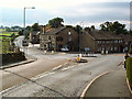
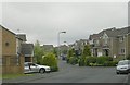


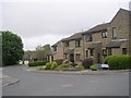
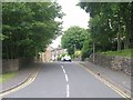
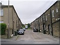
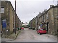
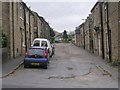

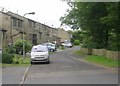
81 photos from this area
Area Information
Key information about the BD15 0LR including its size, population, and administrative classification.
- Area Type
- Postcode
- Area Size
- 3930 m²
- Population
- 1697
- Population Density
- 3321 people/km²
House Prices in BD15 0LR
9
Properties
£171,383
Average Sold Price
£59,300
Lowest Price
£240,000
Highest Price
Showing 9 properties
| Address | Type | Beds | Baths | Last Sale Price | Last Sale Date | |
|---|---|---|---|---|---|---|
| 4 Burniston Close, Wilsden, Bingley, BD15 0LR | Bungalow | 3 | 1 | £220,000 | Feb 2025 | |
| 2 Burniston Close, Wilsden, Bingley, BD15 0LR | Semi-detached | 4 | 1 | £240,000 | May 2024 | |
| 10 Burniston Close, Wilsden, Bingley, BD15 0LR | Semi-detached | 2 | 1 | £230,000 | Aug 2023 | |
| 16 Burniston Close, Wilsden, Bingley, BD15 0LR | Semi-detached | 2 | 1 | £140,000 | Oct 2020 | |
| 6 Burniston Close, Wilsden, Bingley, BD15 0LR | Semi-detached | - | - | £139,000 | Jan 2004 | |
| 14 Burniston Close, Wilsden, Bingley, BD15 0LR | Detached | - | - | £59,300 | Sep 1998 | |
| 18 Burniston Close, Wilsden, Bingley, BD15 0LR | Bungalow | - | - | - | - | |
| 8 Burniston Close, Wilsden, Bingley, BD15 0LR | Semi-detached | - | - | - | - | |
| 12 Burniston Close, Wilsden, Bingley, BD15 0LR | Semi-detached | - | - | - | - |
Energy Efficiency in BD15 0LR
Amenities
Schools
| Rank | School | Type | Entry gender | Ages |
|---|
Explore more schools in this area
Go to Schools tabDemographics
Household Size
Two person
most common
Accommodation Type
Houses
most common
Tenure
74
majority
Ethnic Group
White
most common
Religion
N/A
most common
Household Composition
N/A
most common
Age
47
median
Adults (30-64 years)
most common
Household Deprivation
N/A
with no deprivation
NS-SEC
37
in Lower managerial occupations
Explore more demographic insights in this area
Go to Demographics tabPlanning
Planning Constraints
- Flood RiskPremium
- Ramsar Wetland SitesPremium
- Area of Outstanding Natural BeautyPremium
- Protected Nature ReservePremium
- Protected WoodlandPremium