Area Overview for BD15 0HF
Photos of BD15 0HF
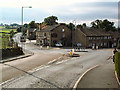
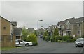


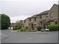
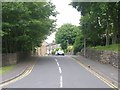
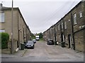
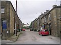
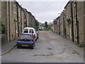

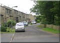
81 photos from this area
Area Information
Key information about the BD15 0HF including its size, population, and administrative classification.
- Area Type
- Postcode
- Area Size
- 6174 m²
- Population
- 2060
- Population Density
- 367 people/km²
House Prices in BD15 0HF
23
Properties
£219,624
Average Sold Price
£143,000
Lowest Price
£330,000
Highest Price
Showing 23 properties
| Address | Type | Beds | Baths | Last Sale Price | Last Sale Date | |
|---|---|---|---|---|---|---|
| 1 Lingbob Mill Fold, Wilsden, Bingley, BD15 0HF | Terraced | 3 | 2 | £237,000 | May 2025 | |
| 2 Lingbob Mill Fold, Wilsden, Bingley, BD15 0HF | Semi-detached | 3 | 1 | £219,950 | Feb 2025 | |
| 21 Lingbob Mill Fold, Wilsden, Bingley, BD15 0HF | Semi-detached | 4 | 2 | £278,000 | Oct 2024 | |
| 20 Lingbob Mill Fold, Wilsden, Bingley, BD15 0HF | Terraced | 4 | 2 | £330,000 | Jul 2023 | |
| 8 Lingbob Mill Fold, Wilsden, Bingley, BD15 0HF | Semi-detached | 3 | 2 | £183,500 | Nov 2021 | |
| 3 Lingbob Mill Fold, Wilsden, Bingley, BD15 0HF | Terraced | 3 | - | £205,000 | Nov 2021 | |
| 6 Lingbob Mill Fold, Wilsden, Bingley, BD15 0HF | Terraced | 3 | - | £180,000 | Sep 2021 | |
| 14 Lingbob Mill Fold, Wilsden, Bingley, BD15 0HF | house | 3 | 1 | £173,000 | Jul 2020 | |
| 17 Lingbob Mill Fold, Wilsden, Bingley, BD15 0HF | Terraced | 3 | 1 | £210,000 | Feb 2019 | |
| 10 Lingbob Mill Fold, Wilsden, Bingley, BD15 0HF | house | 3 | - | £167,000 | Nov 2016 |
Page 1 of 3
Energy Efficiency in BD15 0HF
Amenities
Schools
| Rank | School | Type | Entry gender | Ages |
|---|
Explore more schools in this area
Go to Schools tabDemographics
Household Size
Two person
most common
Accommodation Type
Houses
most common
Tenure
79
majority
Ethnic Group
White
most common
Religion
N/A
most common
Household Composition
N/A
most common
Age
47
median
Adults (30-64 years)
most common
Household Deprivation
N/A
with no deprivation
NS-SEC
43
in Lower managerial occupations
Explore more demographic insights in this area
Go to Demographics tabPlanning
Planning Constraints
- Flood RiskPremium
- Ramsar Wetland SitesPremium
- Area of Outstanding Natural BeautyPremium
- Protected Nature ReservePremium
- Protected WoodlandPremium