Area Overview for BD13 4NQ
Photos of BD13 4NQ
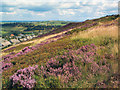
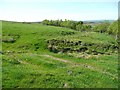
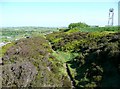
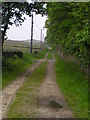

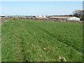
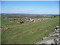
59 photos from this area
Area Information
Key information about the BD13 4NQ including its size, population, and administrative classification.
- Area Type
- Postcode
- Area Size
- 4.4 hectares
- Population
- 2137
- Population Density
- 439 people/km²
House Prices in BD13 4NQ
60
Properties
£100,478
Average Sold Price
£23,385
Lowest Price
£325,000
Highest Price
Showing 60 properties
| Address | Type | Beds | Baths | Last Sale Price | Last Sale Date | |
|---|---|---|---|---|---|---|
| 41 Longhouse Lane, Denholme, Bradford, BD13 4NQ | Semi-detached | 3 | 1 | £165,000 | Jul 2024 | |
| 43 Longhouse Lane, Denholme, Bradford, BD13 4NQ | Semi-detached | 3 | 1 | £155,000 | Apr 2024 | |
| 29 Longhouse Lane, Denholme, Bradford, BD13 4NQ | Semi-detached | 3 | 1 | £143,000 | May 2023 | |
| 3 Longhouse Lane, Denholme, Bradford, BD13 4NQ | Detached | 3 | 1 | £325,000 | Feb 2023 | |
| 52 Longhouse Lane, Denholme, Bradford, BD13 4NQ | house | - | - | £185,000 | Aug 2022 | |
| 64 Longhouse Lane, Denholme, Bradford, BD13 4NQ | house | - | - | £195,500 | Apr 2022 | |
| 14 Longhouse Lane, Denholme, Bradford, BD13 4NQ | Bungalow | - | - | £127,000 | Mar 2022 | |
| 38 Longhouse Lane, Denholme, Bradford, BD13 4NQ | Semi-detached | 3 | 2 | £190,000 | Aug 2021 | |
| 58 Longhouse Lane, Denholme, Bradford, BD13 4NQ | house | 3 | 1 | £168,000 | Oct 2020 | |
| 37 Longhouse Lane, Denholme, Bradford, BD13 4NQ | Semi-detached | 3 | 1 | £110,000 | Aug 2020 |
Page 1 of 6
Energy Efficiency in BD13 4NQ
Amenities
Schools
| Rank | School | Type | Entry gender | Ages |
|---|
Explore more schools in this area
Go to Schools tabDemographics
Household Size
One person
most common
Accommodation Type
Houses
most common
Tenure
61
majority
Ethnic Group
White
most common
Religion
N/A
most common
Household Composition
N/A
most common
Age
47
median
Adults (30-64 years)
most common
Household Deprivation
N/A
with no deprivation
NS-SEC
29
in Lower managerial occupations
Explore more demographic insights in this area
Go to Demographics tabPlanning
Planning Constraints
- Flood RiskPremium
- Ramsar Wetland SitesPremium
- Area of Outstanding Natural BeautyPremium
- Protected Nature ReservePremium
- Protected WoodlandPremium