Area Overview for BD13 4BL
Photos of BD13 4BL
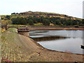
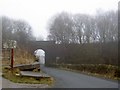
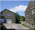
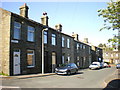
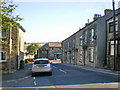
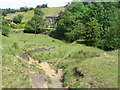
69 photos from this area
Area Information
Key information about the BD13 4BL including its size, population, and administrative classification.
- Area Type
- Postcode
- Area Size
- 5063 m²
- Population
- 2137
- Population Density
- 439 people/km²
House Prices in BD13 4BL
17
Properties
£86,908
Average Sold Price
£36,000
Lowest Price
£158,000
Highest Price
Showing 17 properties
| Address | Type | Beds | Baths | Last Sale Price | Last Sale Date | |
|---|---|---|---|---|---|---|
| 64 Main Road, Denholme, Bradford, BD13 4BL | Terraced | 3 | 1 | £158,000 | Aug 2023 | |
| 70 Main Road, Denholme, Bradford, BD13 4BL | Terraced | 4 | 1 | £80,000 | May 2016 | |
| 72 Main Road, Denholme, Bradford, BD13 4BL | Terraced | - | - | £94,950 | Sep 2005 | |
| 60 Main Road, Denholme, Bradford, BD13 4BL | house | - | - | £36,000 | Mar 2003 | |
| 62 Main Road, Denholme, Bradford, BD13 4BL | Terraced | - | - | £52,500 | Mar 2003 | |
| 42 Main Road, Denholme, Bradford, BD13 4BL | Terraced | - | - | £100,000 | Jul 2002 | |
| 44-46 Main Road, Denholme, Bradford, BD13 4BL | Terraced | - | - | - | - | |
| West Yorkshire Police Authority Accounts Department, West Yorkshire Poilce Authority, Mechanics Institute, Main Road, Denholme, Bradford, BD13 4BL | Office | - | - | - | - | |
| Denholme Library, Mechanics Institute, Main Road, Denholme, Bradford, BD13 4BL | community_day_centre | - | - | - | - | |
| Ground Floor, 56-58 Main Road, Denholme, Bradford, BD13 4BL | Retail | - | - | - | - |
Page 1 of 2
Energy Efficiency in BD13 4BL
Amenities
Schools
| Rank | School | Type | Entry gender | Ages |
|---|
Explore more schools in this area
Go to Schools tabDemographics
Household Size
One person
most common
Accommodation Type
Houses
most common
Tenure
61
majority
Ethnic Group
White
most common
Religion
N/A
most common
Household Composition
N/A
most common
Age
47
median
Adults (30-64 years)
most common
Household Deprivation
N/A
with no deprivation
NS-SEC
29
in Lower managerial occupations
Explore more demographic insights in this area
Go to Demographics tabPlanning
Planning Constraints
- Flood RiskPremium
- Ramsar Wetland SitesPremium
- Area of Outstanding Natural BeautyPremium
- Protected Nature ReservePremium
- Protected WoodlandPremium