Area Overview for BD13 1NJ
Photos of BD13 1NJ
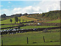
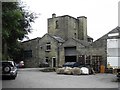
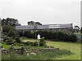
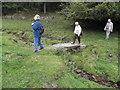
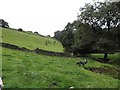
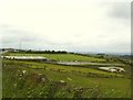
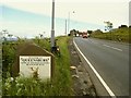
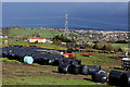
49 photos from this area
Area Information
Key information about the BD13 1NJ including its size, population, and administrative classification.
- Area Type
- Postcode
- Area Size
- 15.2 hectares
- Population
- 1571
- Population Density
- 901 people/km²
House Prices in BD13 1NJ
8
Properties
£305,490
Average Sold Price
£108,000
Lowest Price
£480,000
Highest Price
Showing 8 properties
| Address | Type | Beds | Baths | Last Sale Price | Last Sale Date | |
|---|---|---|---|---|---|---|
| Mountain Lodge, Carter Lane, Queensbury, Bradford, BD13 1NJ | Bungalow | - | - | £480,000 | Oct 2021 | |
| 3 Carter Lane, Queensbury, Bradford, BD13 1NJ | Detached | 4 | 3 | £319,950 | Oct 2019 | |
| Carter House Farm, Carter Lane, Queensbury, Bradford, BD13 1NJ | Detached | - | - | £370,000 | Apr 2018 | |
| Wellfield Hall, Wellfield Gardens, Queensbury, Bradford, BD13 1NJ | Detached | - | - | £249,500 | Nov 2002 | |
| 1 Carter Lane, Queensbury, Bradford, BD13 1NJ | Detached | - | - | £108,000 | Jul 1997 | |
| Caravan At, Lower Springhead Farm, Carter Lane, Queensbury, Bradford, BD13 1NJ | Mobile Home | - | - | - | - | |
| Lower Springhead Farm, Carter Lane, Queensbury, Bradford, BD13 1NJ | house | - | - | - | - | |
| The Milking Barn, Carter Lane, Queensbury, Bradford, BD13 1NJ | house | - | - | - | - |
Energy Efficiency in BD13 1NJ
Amenities
Schools
| Rank | School | Type | Entry gender | Ages |
|---|
Explore more schools in this area
Go to Schools tabDemographics
Household Size
Two person
most common
Accommodation Type
Houses
most common
Tenure
82
majority
Ethnic Group
White
most common
Religion
N/A
most common
Household Composition
N/A
most common
Age
47
median
Adults (30-64 years)
most common
Household Deprivation
N/A
with no deprivation
NS-SEC
33
in Lower managerial occupations
Explore more demographic insights in this area
Go to Demographics tabPlanning
Planning Constraints
- Flood RiskPremium
- Ramsar Wetland SitesPremium
- Area of Outstanding Natural BeautyPremium
- Protected Nature ReservePremium
- Protected WoodlandPremium