Area Overview for BD12 9HP
Photos of BD12 9HP
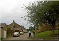
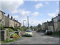
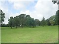
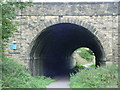
65 photos from this area
Area Information
Key information about the BD12 9HP including its size, population, and administrative classification.
- Area Type
- Postcode
- Area Size
- 1.2 hectares
- Population
- 1421
- Population Density
- 930 people/km²
House Prices in BD12 9HP
15
Properties
£80,453
Average Sold Price
£32,950
Lowest Price
£103,000
Highest Price
Showing 15 properties
| Address | Type | Beds | Baths | Last Sale Price | Last Sale Date | |
|---|---|---|---|---|---|---|
| 12 Pyrah Street, Wyke, Bradford, BD12 9HP | Terraced | 3 | 1 | £87,000 | May 2024 | |
| 6 Pyrah Street, Wyke, Bradford, BD12 9HP | Terraced | 2 | 1 | £96,950 | Feb 2023 | |
| 4 Pyrah Street, Wyke, Bradford, BD12 9HP | house | 2 | - | £89,000 | Oct 2022 | |
| 5 Pyrah Street, Wyke, Bradford, BD12 9HP | house | - | - | £103,000 | May 2021 | |
| 7 Pyrah Street, Wyke, Bradford, BD12 9HP | Terraced | 3 | 1 | £97,500 | Feb 2021 | |
| 16 Pyrah Street, Wyke, Bradford, BD12 9HP | house | - | - | £90,000 | Jun 2018 | |
| 3 Pyrah Street, Wyke, Bradford, BD12 9HP | Terraced | 2 | 1 | £78,000 | Oct 2017 | |
| 11 Pyrah Street, Wyke, Bradford, BD12 9HP | Terraced | 2 | 1 | £67,000 | Dec 2014 | |
| 14 Pyrah Street, Wyke, Bradford, BD12 9HP | house | - | - | £62,500 | Oct 2010 | |
| 13 Pyrah Street, Wyke, Bradford, BD12 9HP | house | - | - | £80,000 | Jan 2007 |
Page 1 of 2
Energy Efficiency in BD12 9HP
Amenities
Schools
| Rank | School | Type | Entry gender | Ages |
|---|
Explore more schools in this area
Go to Schools tabDemographics
Household Size
One person
most common
Accommodation Type
Houses
most common
Tenure
74
majority
Ethnic Group
White
most common
Religion
N/A
most common
Household Composition
N/A
most common
Age
47
median
Adults (30-64 years)
most common
Household Deprivation
N/A
with no deprivation
NS-SEC
30
in Lower managerial occupations
Explore more demographic insights in this area
Go to Demographics tabPlanning
Planning Constraints
- Flood RiskPremium
- Ramsar Wetland SitesPremium
- Area of Outstanding Natural BeautyPremium
- Protected Nature ReservePremium
- Protected WoodlandPremium