Area Overview for BD12 9BY
Photos of BD12 9BY
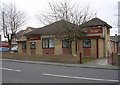
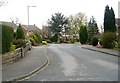
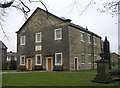

100 photos from this area
Area Information
Key information about the BD12 9BY including its size, population, and administrative classification.
- Area Type
- Postcode
- Area Size
- 1.5 hectares
- Population
- 1204
- Population Density
- 4030 people/km²
House Prices in BD12 9BY
31
Properties
£164,271
Average Sold Price
£58,000
Lowest Price
£320,000
Highest Price
Showing 31 properties
| Address | Type | Beds | Baths | Last Sale Price | Last Sale Date | |
|---|---|---|---|---|---|---|
| 247 Westfield Lane, Wyke, Bradford, BD12 9BY | Bungalow | - | - | £260,000 | May 2025 | |
| 251 Westfield Lane, Wyke, Bradford, BD12 9BY | Semi-detached | 3 | 1 | £205,000 | Feb 2023 | |
| 237 Westfield Lane, Wyke, Bradford, BD12 9BY | Terraced | 4 | 2 | £320,000 | Feb 2023 | |
| 243 Westfield Lane, Wyke, Bradford, BD12 9BY | Bungalow | 2 | 1 | £200,000 | Sep 2021 | |
| 225 Westfield Lane, Wyke, Bradford, BD12 9BY | Semi-detached | 3 | 1 | £135,000 | May 2020 | |
| 178 Westfield Lane, Wyke, Bradford, BD12 9BY | Semi-detached | 3 | - | £157,000 | Sep 2018 | |
| 223 Westfield Lane, Wyke, Bradford, BD12 9BY | Semi-detached | - | - | £150,000 | Aug 2018 | |
| 172 Westfield Lane, Wyke, Bradford, BD12 9BY | Semi-detached | 3 | 1 | £170,000 | Apr 2016 | |
| 180 Westfield Lane, Wyke, Bradford, BD12 9BY | house | - | - | £116,000 | Mar 2012 | |
| 253 Westfield Lane, Wyke, Bradford, BD12 9BY | Semi-detached | 3 | - | £117,000 | Dec 2011 |
Page 1 of 4
Energy Efficiency in BD12 9BY
Amenities
Schools
| Rank | School | Type | Entry gender | Ages |
|---|
Explore more schools in this area
Go to Schools tabDemographics
Household Size
Two person
most common
Accommodation Type
Houses
most common
Tenure
82
majority
Ethnic Group
White
most common
Religion
N/A
most common
Household Composition
N/A
most common
Age
47
median
Adults (30-64 years)
most common
Household Deprivation
N/A
with no deprivation
NS-SEC
33
in Lower managerial occupations
Explore more demographic insights in this area
Go to Demographics tabPlanning
Planning Constraints
- Flood RiskPremium
- Ramsar Wetland SitesPremium
- Area of Outstanding Natural BeautyPremium
- Protected Nature ReservePremium
- Protected WoodlandPremium