Area Overview for BD12 8SB
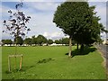
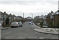
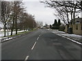
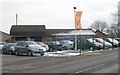
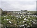
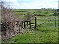
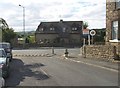
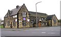
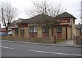
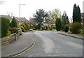
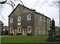
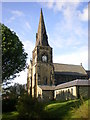
Photos of BD12 8SB
Area Information
Living in the BD12 8SB postcode sector means residing within the historic Wyke Ward of Bradford District, a small residential cluster covering 2,494 square metres of land. Although the total population stands at 1,864 people, the character of this hamlet is defined by its deep historical roots stretching back to the Norman Conquest and the Domesday Survey. Originally documented as a settlement evolving into a linear route along Lower Wyke Lane, the area retains strong links to its past through Moravian settlement influences dating from 1738. You find yourself in a place where the township of Wyke and the adjoining hamlet of Lower Wyke have coexisted since the 17th and 18th centuries. Daily life here reflects a transition from rural origins to a modern residential setting that balances heritage with contemporary needs. The coordinates near 53.75737478553296, -1.7607907406389873 place you approximately 4.5 miles south of Bradford city centre. This location places you within a designated conservation area that protects significant architectural features while sitting alongside the broader industrial history of West Yorkshire. The area is not just a collection of addresses but a defined ward with a legacy of engineering and agriculture. When considering homes in BD12 8SB, you are entering a community shaped by centuries of evolution, from early farmsteads and a manor house to the opening of Wyke Station in 1850.
- Area Type
- Postcode
- Area Size
- 2494 m²
- Population
- 1864
- Population Density
- 2636 people/km²
The housing market in BD12 8SB is characterised by a significant split between ownership and rental tenure. You will find that 49% of homes are owner-occupied, meaning the market has a strong base of permanent residents who have invested in their properties. The remaining 51% of the housing stock is likely rented or shared, which can create a dynamic environment where turnover rates fluctuate based on lease agreements or tenancy changes. This balance often results in a diverse set of occupants, from long-term owners to tenants ranging from professionals to students. Accommodation types are overwhelmingly Houses, which aligns with the historical development of the area along Lower Wyke Lane. This housing typology typically includes detached, semi-detached, and terraced family homes rather than purpose-built apartments or high-density blocks. For buyers looking at homes in this small postcode, this means competition centres on traditional property styles rather than flats. The historical presence of listed buildings and farmsteads in the wider Wyke Ward suggests that many properties may retain period features. When assessing a property, you should look for original elements that reflect the 17th to 19th-century evolution of the homes here. The market is not dominated by speculative build; instead, it is rooted in existing stock that has defined the neighbourhood since the early days of the settlement.
House Prices in BD12 8SB
Showing 8 properties
| Address | Type | Beds | Baths | Last Sale Price | Last Sale Date | |
|---|---|---|---|---|---|---|
| 8 Tor Avenue, Wyke, Bradford, BD12 8SB | Semi-detached | 3 | 1 | £79,000 | Mar 2020 | |
| 1 Tor Avenue, Wyke, Bradford, BD12 8SB | Semi-detached | - | - | £94,000 | May 2008 | |
| 6 Tor Avenue, Wyke, Bradford, BD12 8SB | Semi-detached | - | - | - | - | |
| 3 Tor Avenue, Wyke, Bradford, BD12 8SB | house | - | - | - | - | |
| 2 Tor Avenue, Wyke, Bradford, BD12 8SB | Semi-detached | - | - | - | - | |
| 5 Tor Avenue, Wyke, Bradford, BD12 8SB | house | - | - | - | - | |
| 4 Tor Avenue, Wyke, Bradford, BD12 8SB | house | - | - | - | - | |
| 10 Tor Avenue, Wyke, Bradford, BD12 8SB | house | - | - | - | - |
Energy Efficiency in BD12 8SB
Your daily lifestyle in BD12 8SB benefits from a range of amenities situated within practical reach. For shopping needs, five retail outlets are nearby, including Morrisons Daily Bradford, Asda Wyke, and Co-op Bailiff. These stores cover essential groceries and daily necessities, reducing the need for travel to larger shopping centres. The presence of Asda Wyke specifically anchors the area's retail identity in a town-centre function that dates back to the hamlet's evolution. You can handle routine shopping without leaving the general BD12 area, which adds convenience to your week. Transport and leisure options extend beyond the immediate postcode through the five nearby rail stations mentioned above. Low Moor Railway Station, Brighouse Railway Station, and Halifax Railway Station provide easy access to wider leisure and employment hubs. While the data does not list specific parks or cinemas within the immediate BD12 8SB boundary, the connection to these stations ensures that cultural activities are accessible. The area also retains the spirit of its rural past through its designated conservation status, which protects the green spaces around Lower Wyke Green and early farmsteads. This blend of accessible retail and transport links supports a balanced lifestyle. Residents enjoy the convenience of supermarkets like the Co-op Bailiff while retaining the ability to access broader opportunities via the rail network. Living in BD12 8SB offers a practical balance between local self-sufficiency and regional connectivity.
Amenities
Schools
Families in BD12 8SB have access to educated local educational institutions, with Shirley Manor Primary School situated nearby as the primary option within the immediate vicinity. This institution is rated 'good' by Ofsted, offering a standard recognised for reliable educational outcomes. The presence of a primary school with this rating indicates that early years education is accessible without needing to travel long distances to city centre academies. While the data lists only one primary institution, this school serves as a key anchor for households with young children. The mix of school types available directly influences family decisions when moving to the area. With Shirley Manor Primary School operating at a 'good' standard, parents can expect a baseline of quality provision for primary-level learning. For secondary education, families often rely on options further afield, as the provided data focuses strictly on the immediate primary sector. The concentration of a single, well-rated school suggests a community where educational quality is a defined feature rather than a variable. When evaluating schools near BD12 8SB, the 'good' rating of Shirley Manor Primary School provides a clear factual basis for decision-making. This ensures that children have access to a curriculum that meets national standards while benefiting from the specific local environment of the Wyke Ward.
| Rank | School | Type | Entry gender | Ages |
|---|
Explore more schools in this area
Go to Schools tabDemographics
The community in BD12 8SB reflects a mature population with a median age of 47 years. The most common age group consists of adults between 30 and 64 years, indicating that the neighbourhood is largely populated by families and established professionals rather than young people or retirees. This age profile aligns with a home ownership rate of 49%, suggesting that nearly half of the residents are owner-occupiers. The remaining households likely comprise a mix of investors or young families entering the market. You will find that the predominant ethnic group in the area is White, which contributes to a specific cultural demographic. The accommodation type is primarily Houses, distinguishing this postcode from areas dominated by high-rise flats or terraced blocks. This prevalence of houses supports a quieter, more residential lifestyle compared to denser urban cores. The high population density figure of 747,402 people per square kilometre applied to the total area size reflects the concentrated nature of the land use within the postcode boundary. While the data shows a standard demographic spread for the West Yorkshire region, the concentration of adult residents means the area functions as a stable, established part of Bradford. Living in BD12 8SB offers stability, with a community where the majority of adults are deep into their career and family lives.
Household Size
Accommodation Type
Tenure
Ethnic Group
Religion
Household Composition
Age
Household Deprivation
NS-SEC
Explore more demographic insights in this area
Go to Demographics tabPlanning
Planning Constraints
- Flood RiskPremium
- Ramsar Wetland SitesPremium
- Area of Outstanding Natural BeautyPremium
- Protected Nature ReservePremium
- Protected WoodlandPremium