Area Overview for BD12 8LG
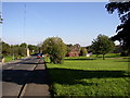
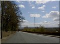
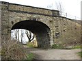
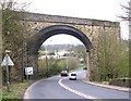
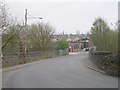
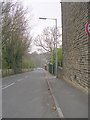
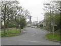
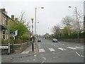
Photos of BD12 8LG
Area Information
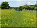
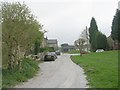
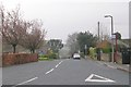
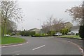
Living in BD12 8LG means inhabiting a small, tightly knit residential cluster in West Yorkshire, just 4.5 miles south of Bradford city centre. The area’s population of 1,864 reflects its compact nature, with homes primarily built as standalone houses rather than flats. Historically, BD12 8LG evolved from a 17th-century hamlet along Lower Wyke Lane, shaped by farmsteads, a manor house, and Moravian settlers who established a church and school in the 18th century. Today, the area retains a rural character despite its proximity to urban infrastructure. Residents benefit from proximity to rail networks, with stations like Low Moor and Brighouse within reach, and a mix of local shops and supermarkets. The area’s listed buildings, including a Grade II church and former boarding school, add to its heritage. While modern connectivity is strong—broadband scores are excellent—daily life here balances historical charm with practical amenities, making it a distinctive choice for those seeking a quiet yet connected community.
- Area Type
- Postcode
- Area Size
- Not available
- Population
- 1864
- Population Density
- 2636 people/km²
The property market in BD12 8LG is defined by its 49% home ownership rate, indicating that nearly half of properties are rented. This suggests a rental market that may offer opportunities for buyers seeking to purchase in a small, low-density area. The predominant accommodation type—houses—reflects a preference for standalone homes, which are more common in rural or semi-rural settings. Given the area’s compact size, property availability is limited, and buyers should consider the proximity to Bradford’s urban amenities, which may influence property values. The mix of owner-occupied and rented properties means competition for homes could be fierce, particularly for those seeking larger properties. For buyers, the focus on houses may appeal to families or individuals prioritising space and privacy. However, the small population and limited housing stock mean the market is niche, requiring careful consideration of long-term viability and potential for capital growth.
House Prices in BD12 8LG
No properties found in this postcode.
Energy Efficiency in BD12 8LG
The lifestyle in BD12 8LG is shaped by its proximity to a range of amenities within practical reach. Retail options include five notable venues: Asda Wyke, Morrisons Daily Bradford, and Co-op Bailiff, providing residents with access to supermarkets and everyday shopping. For transportation, five rail stations—Low Moor, Brighouse, and Halifax—are within easy reach, offering connections to major towns and cities. While the area retains a rural character, these amenities ensure convenience for daily errands and travel. The presence of a primary school and historical sites like the Grade II-listed church and former boarding school adds cultural and educational value. The small population and compact layout mean the community is close-knit, with local businesses and services catering to immediate needs. This blend of practical amenities and historical charm supports a lifestyle that balances simplicity with accessibility, ideal for those seeking a quieter, connected existence without sacrificing convenience.
Amenities
Schools
The nearest school to BD12 8LG is Shirley Manor Primary School, which serves the area’s primary education needs. The school is listed twice in the data, but both entries confirm it is a primary school with an Ofsted rating of ‘good’. This rating indicates that the school meets national standards for teaching quality, pupil outcomes, and leadership. As a primary school, it caters to children aged 4–11, making it a critical resource for families with young children. The absence of secondary schools in the immediate vicinity means parents may need to consider commuting to nearby towns for secondary education. However, the ‘good’ rating suggests that the school provides a reliable foundation for early learning, which is a significant advantage for families prioritising quality education. The proximity of a well-regarded primary school enhances the area’s appeal for households with children.
| Rank | School | Type | Entry gender | Ages |
|---|
Explore more schools in this area
Go to Schools tabDemographics
BD12 8LG has a median age of 47, with the majority of residents falling in the 30-64 age range. This suggests a mature, stable community with a focus on family life and long-term residency. Home ownership is at 49%, slightly below the national average, indicating a mix of owner-occupied and rented properties. The area is predominantly composed of houses, reflecting a preference for single-family dwellings over flats or apartments. The predominant ethnic group is White, though no specific diversity statistics are provided. The age profile and housing type imply a community where many residents have established careers and families, with limited generational turnover. This demographic structure may influence local services and amenities, which are tailored to the needs of middle-aged adults and older residents. The absence of specific data on deprivation or income levels means the area’s quality of life remains unquantified in these terms, but the presence of schools and retail options suggests moderate accessibility to essential services.
Household Size
Accommodation Type
Tenure
Ethnic Group
Religion
Household Composition
Age
Household Deprivation
NS-SEC
Explore more demographic insights in this area
Go to Demographics tabPlanning
Planning Constraints
- Flood RiskPremium
- Ramsar Wetland SitesPremium
- Area of Outstanding Natural BeautyPremium
- Protected Nature ReservePremium
- Protected WoodlandPremium