Area Overview for BD12 0UU
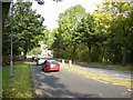
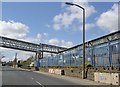
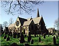
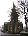
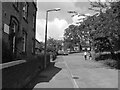
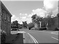
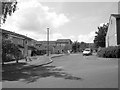
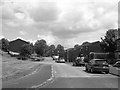
Photos of BD12 0UU
Area Information
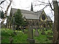
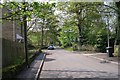
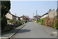
Living in BD12 0UU means inhabiting a small, tightly knit residential cluster in West Yorkshire, just 4.5 miles south of Bradford city centre. With a population of 1,663 and a density of 814 people per square kilometre, this area retains a distinct character shaped by its rural origins. The township of Wyke and its hamlet of Lower Wyke have roots stretching back to the Norman Conquest, with a history marked by Moravian settlers, a 19th-century girls’ boarding school, and listed buildings that contribute to its conservation area status. Today, the area balances historical charm with modern amenities, including five nearby railway stations and accessible retail hubs. Daily life here is defined by proximity to transport links, a focus on owner-occupied housing, and a community skewed toward adults aged 30–64. While the area’s compact size means limited expansion, its heritage and infrastructure make it a practical choice for those seeking a quieter alternative to Bradford’s urban core.
- Area Type
- Postcode
- Area Size
- Not available
- Population
- 1663
- Population Density
- 814 people/km²
BD12 0UU is primarily a housing market dominated by owner-occupied properties, with 47% of homes owned by residents. The accommodation type is exclusively houses, which contrasts with areas where flats or apartments predominate. This suggests a focus on family homes and a quieter, more private lifestyle. Given the area’s small size and low population density, the housing stock is likely limited, with limited scope for new developments. For buyers, this means competition for existing properties and a need to consider proximity to nearby areas for additional options. The predominance of houses also implies higher land values and potentially larger properties compared to urban centres. However, the lack of rental data means it is unclear whether the market is balanced between owner-occupiers and tenants.
House Prices in BD12 0UU
No properties found in this postcode.
Energy Efficiency in BD12 0UU
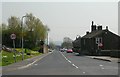
The lifestyle in BD12 0UU is shaped by its proximity to retail and transport hubs. Five railway stations, including Low Moor and Bradford Interchange, offer easy access to Bradford’s city centre and surrounding areas. Retail options include major chains such as Tesco Low and Morrisons Daily Bradford, ensuring everyday shopping needs are met locally. While the area lacks detailed data on parks or leisure facilities, its conservation status and listed buildings suggest a preserved rural character. The presence of the Red Lion public house and historical sites like the Moravian church adds to the area’s distinct charm. This blend of practical amenities and heritage creates a convenient yet historically rich environment for residents.
Amenities
Schools
The nearest school to BD12 0UU is Appleton Academy, an academy with a good Ofsted rating. This single school serves the area’s educational needs, though its focus on secondary education may require families to consider additional options for primary schooling. The absence of other schools in the immediate vicinity means parents should assess commuting distances to nearby institutions. Appleton Academy’s good rating indicates a reliable standard of education, but the lack of diverse school types—such as primary or specialist institutions—may limit choices for families with children of different ages. For those prioritising proximity to schools, this area’s limited options should be weighed against its other advantages.
| Rank | School | Type | Entry gender | Ages |
|---|
Explore more schools in this area
Go to Schools tabDemographics
The population of BD12 0UU is predominantly adults aged 30–64, with a median age of 47. This suggests a community with established households and a focus on long-term residency. Home ownership sits at 47%, indicating a mix of owner-occupied properties and rental stock. The area is characterised by houses rather than flats, reflecting a preference for traditional family homes. The predominant ethnic group is White, with no data provided on other demographics. The age profile and housing type imply a stable, mature population less reliant on student or transient demographics. However, the lack of specific data on deprivation or diversity means the area’s social dynamics remain partially opaque. For buyers, this suggests a community with a clear identity but limited insight into broader socioeconomic variation.
Household Size
Accommodation Type
Tenure
Ethnic Group
Religion
Household Composition
Age
Household Deprivation
NS-SEC
Explore more demographic insights in this area
Go to Demographics tabPlanning
Planning Constraints
- Flood RiskPremium
- Ramsar Wetland SitesPremium
- Area of Outstanding Natural BeautyPremium
- Protected Nature ReservePremium
- Protected WoodlandPremium