Area Overview for BD12 0SF
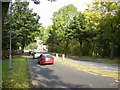
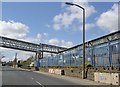
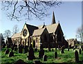
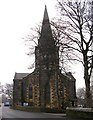
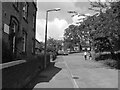
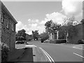
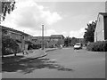
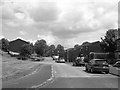
Photos of BD12 0SF
Area Information
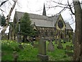
BD12 0SF is a small residential postcode area within the Royds ward of Bradford, West Yorkshire. With a population of 1,756, it reflects a compact, tightly knit community shaped by decades of regeneration. The area sits south of Bradford’s city centre, encompassing parts of Buttershaw, Woodside, and Wibsey, with historic sites like Royds Hall—a Grade II* listed building—anchoring its character. Once marked by deprivation and run-down housing, Royds has transformed into a model of community-led renewal, blending suburban housing with local businesses and public amenities. Today, it offers a mix of older listed properties and modern developments, supported by initiatives like the £5 million Enterprise Park, which employs over 300 residents. The area’s identity is rooted in its history, from 14th-century manor ties to 20th-century social reform, creating a unique blend of heritage and progress. Living in BD12 0SF means being part of a community that prioritises collaboration, with a focus on improving life opportunities and maintaining a strong local identity.
- Area Type
- Postcode
- Area Size
- Not available
- Population
- 1756
- Population Density
- 3303 people/km²
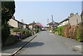
The property market in BD12 0SF is characterised by a high rate of home ownership (65%) and a predominance of houses, reflecting a residential area focused on family living. This suggests that the housing stock is largely owner-occupied, with fewer rental properties compared to other parts of Bradford. The presence of houses, rather than flats or apartments, indicates a suburban layout with potentially larger properties, which may appeal to buyers seeking space and privacy. However, the small size of the postcode area means the housing options are limited, and buyers may need to look beyond BD12 0SF to find additional properties. The regeneration efforts in the ward, including the Enterprise Park and community facilities, have likely increased property values and desirability. For buyers, this area offers a mix of historic and modern homes, but the limited stock means competition could be fierce, particularly for families or those seeking larger homes.
House Prices in BD12 0SF
No properties found in this postcode.
Energy Efficiency in BD12 0SF
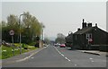
Life in BD12 0SF is enriched by a range of amenities within practical reach. Retail options include major supermarkets like Tesco Low and Co-op Wibsey, ensuring everyday shopping needs are met. The nearby railway stations—Low Moor, Bradford Interchange, and Bradford Foster Square—connect residents to broader transport networks, facilitating commuting and access to urban centres. The Enterprise Park, a key local employer, contributes to the area’s economic vitality, offering jobs and business opportunities. Community facilities such as the Royds Healthy Living Centre and Homework Clubs support both physical well-being and educational needs. The area’s historic character, including listed buildings like Royds Hall, adds cultural value, while the ward’s regeneration has prioritised green spaces and social cohesion. This mix of practical amenities, employment prospects, and community-focused infrastructure creates a balanced lifestyle, blending convenience with a sense of local identity.
Amenities
Schools
Residents of BD12 0SF have access to a range of schools, including primary and academy institutions. Woodside Primary School and Children’s Centre and Delf Hill Middle School cater to younger children, while Woodside Middle School and Woodside Academy provide secondary education. Notably, Woodside Academy holds a ‘good’ Ofsted rating, indicating a school that meets high standards in teaching and student outcomes. The mix of school types offers families flexibility, with primary schools for early education and academies offering a broader curriculum. The presence of multiple schools in close proximity suggests a well-served educational environment, which is particularly valuable for families with children. The focus on education is reinforced by the ward’s history of community-led regeneration, which included investments in local facilities like the Royds Healthy Living Centre and Homework Clubs. For prospective buyers, the availability of quality schools is a key consideration, especially for those prioritising family-friendly amenities.
| Rank | School | Type | Entry gender | Ages |
|---|
Explore more schools in this area
Go to Schools tabDemographics
The population of BD12 0SF is predominantly middle-aged, with a median age of 47 and the most common age range being adults aged 30–64. This suggests a community with established residents, many of whom may be in their prime working years or nearing retirement. Home ownership is high, at 65%, indicating a stable, owner-occupied area where families and long-term residents are likely to be found. The accommodation type is primarily houses, which aligns with the suburban character of the ward. The predominant ethnic group is White, reflecting the broader demographic patterns of the region. While no specific deprivation data is provided, the historical context of regeneration efforts—such as the 1990s project that targeted unemployment and poor housing—suggests that quality of life has improved significantly. The mix of age groups and home ownership levels points to a community that balances generational stability with ongoing development.
Household Size
Accommodation Type
Tenure
Ethnic Group
Religion
Household Composition
Age
Household Deprivation
NS-SEC
Explore more demographic insights in this area
Go to Demographics tabPlanning
Planning Constraints
- Flood RiskPremium
- Ramsar Wetland SitesPremium
- Area of Outstanding Natural BeautyPremium
- Protected Nature ReservePremium
- Protected WoodlandPremium