Area Overview for BD12 0LD
Photos of BD12 0LD
Area Information
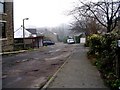
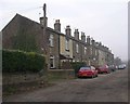
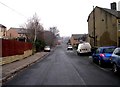
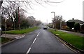
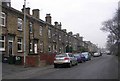
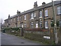
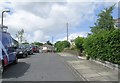
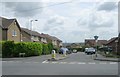
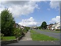
BD12 0LD is a small, tightly knit residential postcode area in West Yorkshire, encompassing the Wyke and Lower Wyke settlements. With a population of 1,595 and a high density of 1,417 people per square kilometre, it reflects a compact, established community. Historically rooted, the area dates back to the Norman Conquest and evolved as a rural hamlet along Lower Wyke Lane, shaped by 18th-century Moravian settlers and farmsteads. Today, it retains a distinct character, with 63 listed buildings and a conservation area designation. Despite its proximity to Bradford—just 4.5 miles north—the area maintains a quieter, semi-rural feel. Residents benefit from nearby rail links, including Low Moor and Bradford Interchange stations, and a mix of local amenities. The high home ownership rate (76%) and predominance of houses suggest a stable, long-term community. For buyers, BD12 0LD offers a blend of historical charm and practical connectivity, ideal for those seeking a peaceful yet accessible location.
- Area Type
- Postcode
- Area Size
- Not available
- Population
- 1595
- Population Density
- 1417 people/km²
The property market in BD12 0LD is characterised by high home ownership (76%) and a predominance of houses over flats or apartments. This suggests a community where long-term residency is common, with properties likely to be family homes or owner-occupied investments. The small postcode area means the housing stock is limited, and buyers may need to consider nearby districts for additional options. The focus on houses rather than rental properties indicates a market driven by private ownership rather than landlord activity. For prospective buyers, this stability could mean lower turnover and potentially higher property values, though the area’s size may limit choice. The historical character of the area, including listed buildings and conservation status, may also influence property desirability, offering unique architectural features that appeal to buyers seeking distinctiveness.
House Prices in BD12 0LD
No properties found in this postcode.
Energy Efficiency in BD12 0LD
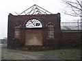
Living in BD12 0LD offers access to essential amenities within practical reach. Nearby retail options include Tesco Low, Asda Wyke, and Morrisons Daily Bradford, providing everyday shopping convenience. The area’s historical character is complemented by the Red Lion public house, a local landmark with a long-standing presence. While parks and green spaces are not explicitly mentioned, the conservation area status and listed buildings suggest preserved natural and architectural features. The nearby railway stations connect residents to broader networks, enabling access to cultural, educational, and leisure opportunities in Bradford and surrounding towns. The mix of retail, historic sites, and transport links creates a lifestyle that balances local charm with practicality, ideal for those who value both heritage and accessibility.
Amenities
Schools
| Rank | School | Type | Entry gender | Ages |
|---|
Explore more schools in this area
Go to Schools tabDemographics
The population of BD12 0LD has a median age of 47, with the majority of residents aged 30–64. This suggests a mature, possibly family-oriented community. Home ownership is high at 76%, and the area is predominantly composed of houses rather than flats or apartments. The predominant ethnic group is White, reflecting a relatively homogenous demographic. While specific data on deprivation is not provided, the age profile and ownership figures imply a stable, established population. The absence of significant rental properties indicates a focus on long-term residency rather than transient tenancy. The age range and ownership statistics together suggest a community with a strong sense of place, where many residents have lived for years or decades. This stability may contribute to a cohesive local culture, though the area’s small size means social interactions are likely to be closely knit.
Household Size
Accommodation Type
Tenure
Ethnic Group
Religion
Household Composition
Age
Household Deprivation
NS-SEC
Explore more demographic insights in this area
Go to Demographics tabPlanning
Planning Constraints
- Flood RiskPremium
- Ramsar Wetland SitesPremium
- Area of Outstanding Natural BeautyPremium
- Protected Nature ReservePremium
- Protected WoodlandPremium