Area Overview for BD12 0HF
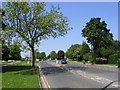
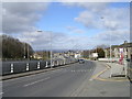
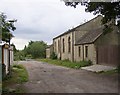
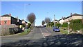
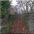
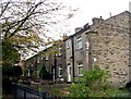
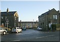
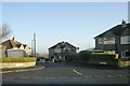
Photos of BD12 0HF
Area Information
Living in BD12 0HF means inhabiting a compact, historically rich postcode area in West Yorkshire. With a population of 1,525 spread across 2,225 square metres, the density here is exceptionally high, reflecting a tightly knit community. The area’s roots trace back to the Norman Conquest, with settlements evolving around Lower Wyke Lane and a 19th-century Moravian church. Despite its proximity to Bradford city centre—just 4.5 miles away—BD12 0HF retains a rural character, marked by listed buildings, farmstead remnants, and conservation area status. Daily life is shaped by its small-scale residential cluster, where well-spaced homes and historic structures coexist. The area’s charm lies in its preservation of heritage, from the Red Lion public house to the former Moravian girls’ school. However, its compact size means residents must balance the benefits of a low-flood-risk zone with the practicalities of limited local amenities, relying on nearby Bradford for broader services. This postcode is ideal for those seeking a blend of history, quiet living, and strategic location near urban hubs.
- Area Type
- Postcode
- Area Size
- 2225 m²
- Population
- 1525
- Population Density
- 3548 people/km²
The property market in BD12 0HF is characterised by a high rate of home ownership (76%) and a focus on houses rather than flats or apartments. This suggests a market dominated by owner-occupied properties, likely appealing to families or individuals seeking stable, long-term residences. The prevalence of houses indicates a housing stock that may be older, with many properties retaining historical features due to the area’s conservation status. Given the postcode’s small size, the immediate surroundings offer limited new developments, meaning buyers must consider existing stock. The high home ownership rate also implies a competitive market for available properties, with potential for capital growth in a low-flood-risk zone. However, the area’s compact nature means buyers should assess proximity to essential services, as local amenities are sparse and require travel to nearby towns like Bradford.
House Prices in BD12 0HF
Showing 1 properties
| Address | Type | Beds | Baths | Last Sale Price | Last Sale Date | |
|---|---|---|---|---|---|---|
| Former 146, Cleckheaton Road, Bradford, BD12 0HF | Detached | - | - | - | - |
Energy Efficiency in BD12 0HF
The lifestyle in BD12 0HF is shaped by its proximity to practical amenities, though local options are limited. Within reach are five retail venues, including Tesco Low, Morrisons Bankfoot, and Co-op Wibsey, providing essential shopping needs. The area’s character is defined by its historic conservation status, with listed buildings and remnants of 18th-century Moravian settlements adding a unique architectural flavour. While parks or green spaces are not explicitly named in the data, the area’s rural feel suggests accessible open spaces. The presence of multiple rail stations ensures easy access to dining, leisure, and cultural opportunities in Bradford. However, the small postcode area means residents must travel for more extensive amenities. The blend of historic charm and practical retail access creates a balanced lifestyle, though the compact nature of the area may require planning for daily errands and social activities beyond the immediate vicinity.
Amenities
Schools
The only named school near BD12 0HF is Netherlands Avenue School and Community Nursery, which is designated as a special school. No Ofsted rating is provided in the data, so its academic performance or facilities cannot be assessed here. The presence of a special school suggests the area may cater to families with children requiring tailored educational support. However, the lack of other schools in the immediate vicinity means residents may need to travel to nearby towns for additional educational options. For families prioritising a range of school types, including primary, secondary, or mainstream institutions, BD12 0HF’s limited local provision could be a consideration. The school’s role as a community nursery also implies it serves both educational and social functions, potentially offering childcare and community activities.
| Rank | School | Type | Entry gender | Ages |
|---|
Explore more schools in this area
Go to Schools tabDemographics
The community in BD12 0HF is predominantly composed of adults aged 30–64, with a median age of 47. This suggests a mature, established population, likely with long-term ties to the area. Home ownership is high at 76%, indicating a stable demographic with a strong preference for owning property. The accommodation type is largely houses, reflecting a traditional, possibly family-oriented housing stock. The predominant ethnic group is White, with no specific data on other demographics provided. The high home ownership rate and age profile suggest a community focused on long-term residency rather than transient populations. However, the lack of data on deprivation or diversity means broader social dynamics remain unexplored. For prospective buyers, the demographic profile implies a low turnover of properties and a potential demand for family-friendly housing, though the area’s small size may limit housing diversity.
Household Size
Accommodation Type
Tenure
Ethnic Group
Religion
Household Composition
Age
Household Deprivation
NS-SEC
Explore more demographic insights in this area
Go to Demographics tabPlanning
Planning Constraints
- Flood RiskPremium
- Ramsar Wetland SitesPremium
- Area of Outstanding Natural BeautyPremium
- Protected Nature ReservePremium
- Protected WoodlandPremium