Area Overview for BD11 2LU
Photos of BD11 2LU
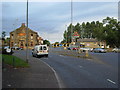
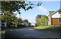
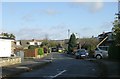
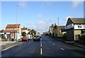
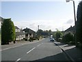
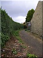
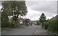
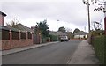
100 photos from this area
Area Information
Key information about the BD11 2LU including its size, population, and administrative classification.
- Area Type
- Postcode
- Area Size
- 3572 m²
- Population
- 1684
- Population Density
- 1248 people/km²
House Prices in BD11 2LU
11
Properties
£153,375
Average Sold Price
£62,000
Lowest Price
£260,000
Highest Price
Showing 11 properties
| Address | Type | Beds | Baths | Last Sale Price | Last Sale Date | |
|---|---|---|---|---|---|---|
| 620 Bradford Road, Birkenshaw, Bradford, BD11 2LU | Terraced | 1 | 1 | £110,000 | Jul 2025 | |
| 616 Bradford Road, Birkenshaw, Bradford, BD11 2LU | Semi-detached | 3 | 1 | £164,000 | Nov 2024 | |
| 612 Bradford Road, Birkenshaw, Bradford, BD11 2LU | Terraced | 3 | 1 | £220,000 | Sep 2024 | |
| 606 Bradford Road, Birkenshaw, Bradford, BD11 2LU | house | 4 | 3 | £260,000 | Apr 2024 | |
| 618 Bradford Road, Birkenshaw, Bradford, BD11 2LU | house | 2 | 1 | £133,000 | Nov 2022 | |
| 614 Bradford Road, Birkenshaw, Bradford, BD11 2LU | house | - | - | £135,750 | Nov 2017 | |
| 628 Bradford Road, Birkenshaw, Bradford, BD11 2LU | Terraced | 3 | - | £118,000 | Dec 2014 | |
| 608 Bradford Road, Birkenshaw, Bradford, BD11 2LU | house | - | - | £185,000 | Dec 2013 | |
| 604 Bradford Road, Birkenshaw, Bradford, BD11 2LU | house | - | - | £146,000 | Sep 2005 | |
| 626 Bradford Road, Birkenshaw, Bradford, BD11 2LU | Terraced | 1 | 1 | £62,000 | Oct 2002 |
Page 1 of 2
Energy Efficiency in BD11 2LU
Amenities
Schools
| Rank | School | Type | Entry gender | Ages |
|---|
Explore more schools in this area
Go to Schools tabDemographics
Household Size
Two person
most common
Accommodation Type
Houses
most common
Tenure
82
majority
Ethnic Group
White
most common
Religion
N/A
most common
Household Composition
N/A
most common
Age
47
median
Adults (30-64 years)
most common
Household Deprivation
N/A
with no deprivation
NS-SEC
41
in Lower managerial occupations
Explore more demographic insights in this area
Go to Demographics tabPlanning
Planning Constraints
- Flood RiskPremium
- Ramsar Wetland SitesPremium
- Area of Outstanding Natural BeautyPremium
- Protected Nature ReservePremium
- Protected WoodlandPremium