Area Overview for BD11 1LU
Photos of BD11 1LU
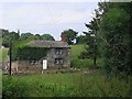
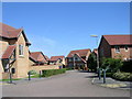
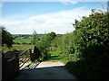
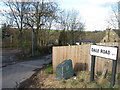
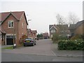
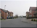
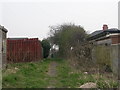
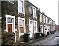
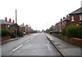
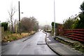

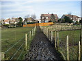
100 photos from this area
Area Information
Key information about the BD11 1LU including its size, population, and administrative classification.
- Area Type
- Postcode
- Area Size
- 32.6 hectares
- Population
- 2172
- Population Density
- 973 people/km²
House Prices in BD11 1LU
40
Properties
£271,513
Average Sold Price
£95,000
Lowest Price
£495,000
Highest Price
Showing 40 properties
| Address | Type | Beds | Baths | Last Sale Price | Last Sale Date | |
|---|---|---|---|---|---|---|
| 19 Old Lane, Drighlington, Bradford, BD11 1LU | house | - | - | £410,000 | Mar 2025 | |
| 23 Old Lane, Drighlington, Bradford, BD11 1LU | house | - | - | £280,000 | Mar 2025 | |
| Nethertown Farm, Old Lane, Drighlington, Bradford, BD11 1LU | Bungalow | 3 | 2 | £163,750 | Jan 2025 | |
| 24 Old Lane, Drighlington, Bradford, BD11 1LU | house | - | - | £250,000 | Sep 2023 | |
| 28 Old Lane, Drighlington, Bradford, BD11 1LU | Cottage | 3 | 1 | £182,000 | Aug 2023 | |
| Tong Village View, 34 Old Lane, Drighlington, Bradford, BD11 1LU | Detached | 5 | 3 | £495,000 | Dec 2022 | |
| 38 Old Lane, Drighlington, Bradford, BD11 1LU | house | 4 | 4 | £370,000 | Dec 2020 | |
| 30 Old Lane, Drighlington, Bradford, BD11 1LU | house | - | - | £169,950 | Sep 2013 | |
| Wyeverne, Old Lane, Drighlington, Bradford, BD11 1LU | house | - | - | £220,000 | Sep 2011 | |
| 34A Old Lane, Drighlington, Bradford, BD11 1LU | Detached | - | - | £495,000 | Sep 2009 |
Page 1 of 4
Energy Efficiency in BD11 1LU
Amenities
Schools
| Rank | School | Type | Entry gender | Ages |
|---|
Explore more schools in this area
Go to Schools tabDemographics
Household Size
Two person
most common
Accommodation Type
Houses
most common
Tenure
78
majority
Ethnic Group
White
most common
Religion
N/A
most common
Household Composition
N/A
most common
Age
47
median
Adults (30-64 years)
most common
Household Deprivation
N/A
with no deprivation
NS-SEC
38
in Lower managerial occupations
Explore more demographic insights in this area
Go to Demographics tabPlanning
Planning Constraints
- Flood RiskPremium
- Ramsar Wetland SitesPremium
- Area of Outstanding Natural BeautyPremium
- Protected Nature ReservePremium
- Protected WoodlandPremium