Area Overview for BD11 1EG
Photos of BD11 1EG

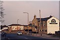
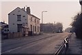
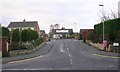
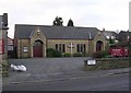

100 photos from this area
Area Information
Key information about the BD11 1EG including its size, population, and administrative classification.
- Area Type
- Postcode
- Area Size
- 1.6 hectares
- Population
- 2172
- Population Density
- 973 people/km²
House Prices in BD11 1EG
41
Properties
£293,896
Average Sold Price
£187,200
Lowest Price
£399,995
Highest Price
Showing 41 properties
| Address | Type | Beds | Baths | Last Sale Price | Last Sale Date | |
|---|---|---|---|---|---|---|
| 12 Winterfell Road, Drighlington, Bradford, BD11 1EG | Detached | 3 | 2 | £299,995 | Nov 2025 | |
| 17 Winterfell Road, Drighlington, Bradford, BD11 1EG | Detached | 3 | 2 | £339,995 | Mar 2025 | |
| 19 Winterfell Road, Drighlington, Bradford, BD11 1EG | house | - | - | £269,995 | Dec 2024 | |
| 21 Winterfell Road, Drighlington, Bradford, BD11 1EG | house | - | - | £269,995 | Dec 2024 | |
| 23 Winterfell Road, Drighlington, Bradford, BD11 1EG | house | - | - | £354,995 | Dec 2024 | |
| 20 Winterfell Road, Drighlington, Bradford, BD11 1EG | Detached | 3 | 3 | £320,000 | Aug 2024 | |
| 8 Winterfell Road, Drighlington, Bradford, BD11 1EG | Detached | 4 | 2 | £372,500 | Jul 2024 | |
| 30 Winterfell Road, Drighlington, Bradford, BD11 1EG | house | - | - | £324,995 | Dec 2023 | |
| 42 Winterfell Road, Drighlington, Bradford, BD11 1EG | house | - | - | £399,995 | Jun 2023 | |
| 32 Winterfell Road, Drighlington, Bradford, BD11 1EG | Semi-detached | - | - | £249,995 | May 2023 |
Page 1 of 5
Energy Efficiency in BD11 1EG
Amenities
Schools
| Rank | School | Type | Entry gender | Ages |
|---|
Explore more schools in this area
Go to Schools tabDemographics
Household Size
Two person
most common
Accommodation Type
Houses
most common
Tenure
78
majority
Ethnic Group
White
most common
Religion
N/A
most common
Household Composition
N/A
most common
Age
47
median
Adults (30-64 years)
most common
Household Deprivation
N/A
with no deprivation
NS-SEC
38
in Lower managerial occupations
Explore more demographic insights in this area
Go to Demographics tabPlanning
Planning Constraints
- Flood RiskPremium
- Ramsar Wetland SitesPremium
- Area of Outstanding Natural BeautyPremium
- Protected Nature ReservePremium
- Protected WoodlandPremium