Area Overview for BD11 1AT
Photos of BD11 1AT

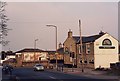
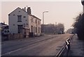
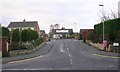
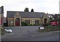

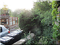
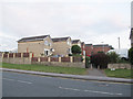
100 photos from this area
Area Information
Key information about the BD11 1AT including its size, population, and administrative classification.
- Area Type
- Postcode
- Area Size
- 1.0 hectares
- Population
- 2172
- Population Density
- 973 people/km²
House Prices in BD11 1AT
10
Properties
£218,500
Average Sold Price
£97,000
Lowest Price
£360,000
Highest Price
Showing 10 properties
| Address | Type | Beds | Baths | Last Sale Price | Last Sale Date | |
|---|---|---|---|---|---|---|
| 169 Whitehall Road, Drighlington, Bradford, BD11 1AT | Detached | 2 | 1 | £97,000 | Aug 2015 | |
| The Old Chapel, Whitehall Road, Drighlington, Bradford, BD11 1AT | Detached | 5 | 4 | £360,000 | Apr 2015 | |
| 171 Whitehall Road, Drighlington, Bradford, BD11 1AT | Detached | 3 | 2 | £198,500 | Oct 2014 | |
| 177 Whitehall Road, Drighlington, Bradford, BD11 1AT | Terraced | 3 | - | - | - | |
| 155 Whitehall Road, Drighlington, Bradford, BD11 1AT | house | 2 | - | - | - | |
| Silver Fields, 139 Whitehall Road, Drighlington, Bradford, BD11 1AT | house | - | - | - | - | |
| Mcfaddens Car Sales Ltd, Car Display Area, 177A Whitehall Road, Drighlington, Bradford, BD11 1AT | commercial | - | - | - | - | |
| 175 Whitehall Road, Drighlington, Bradford, BD11 1AT | Terraced | - | - | - | - | |
| 151-153 Whitehall Road, Drighlington, Bradford, BD11 1AT | Semi-detached | - | - | - | - | |
| 173 Whitehall Road, Drighlington, Bradford, BD11 1AT | Terraced | - | - | - | - |
Energy Efficiency in BD11 1AT
Amenities
Schools
| Rank | School | Type | Entry gender | Ages |
|---|
Explore more schools in this area
Go to Schools tabDemographics
Household Size
Two person
most common
Accommodation Type
Houses
most common
Tenure
78
majority
Ethnic Group
White
most common
Religion
N/A
most common
Household Composition
N/A
most common
Age
47
median
Adults (30-64 years)
most common
Household Deprivation
N/A
with no deprivation
NS-SEC
38
in Lower managerial occupations
Explore more demographic insights in this area
Go to Demographics tabPlanning
Planning Constraints
- Flood RiskPremium
- Ramsar Wetland SitesPremium
- Area of Outstanding Natural BeautyPremium
- Protected Nature ReservePremium
- Protected WoodlandPremium