Area Overview for BD10 9RJ
Photos of BD10 9RJ
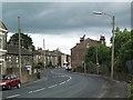
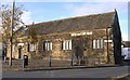
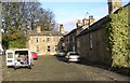
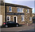
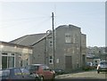
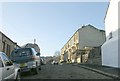
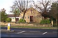
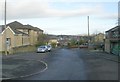
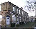

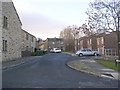
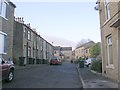
100 photos from this area
Area Information
Key information about the BD10 9RJ including its size, population, and administrative classification.
- Area Type
- Postcode
- Area Size
- 7951 m²
- Population
- 1901
- Population Density
- 5687 people/km²
House Prices in BD10 9RJ
11
Properties
£171,556
Average Sold Price
£53,000
Lowest Price
£248,450
Highest Price
Showing 11 properties
| Address | Type | Beds | Baths | Last Sale Price | Last Sale Date | |
|---|---|---|---|---|---|---|
| 44 Railway Road, Bradford, BD10 9RJ | Semi-detached | 2 | 1 | £145,000 | Aug 2025 | |
| 40 Railway Road, Bradford, BD10 9RJ | Detached | - | - | £235,000 | Nov 2023 | |
| 24 Railway Road, Bradford, BD10 9RJ | Semi-detached | 5 | 1 | £248,450 | Mar 2021 | |
| 18 Railway Road, Bradford, BD10 9RJ | Semi-detached | 3 | 1 | £144,000 | Nov 2018 | |
| 42 Railway Road, Bradford, BD10 9RJ | Semi-detached | 2 | 1 | £120,000 | Apr 2018 | |
| 30 Railway Road, Bradford, BD10 9RJ | house | - | - | £180,000 | May 2016 | |
| 28 Railway Road, Bradford, BD10 9RJ | house | 5 | - | £247,000 | Oct 2012 | |
| 22 Railway Road, Bradford, BD10 9RJ | house | 5 | - | £53,000 | Oct 1997 | |
| Bowling Green, Idle Recreation Ground, Cross Road, Idle, Bradford, BD10 9RJ | Leisure | - | - | - | - | |
| Unit 5, Murphys Yard, Railway Road, Bradford, BD10 9RJ | Terraced | - | - | - | - |
Page 1 of 2
Energy Efficiency in BD10 9RJ
Amenities
Schools
| Rank | School | Type | Entry gender | Ages |
|---|
Explore more schools in this area
Go to Schools tabDemographics
Household Size
One person
most common
Accommodation Type
Houses
most common
Tenure
71
majority
Ethnic Group
White
most common
Religion
N/A
most common
Household Composition
N/A
most common
Age
47
median
Adults (30-64 years)
most common
Household Deprivation
N/A
with no deprivation
NS-SEC
32
in Lower managerial occupations
Explore more demographic insights in this area
Go to Demographics tabPlanning
Planning Constraints
- Flood RiskPremium
- Ramsar Wetland SitesPremium
- Area of Outstanding Natural BeautyPremium
- Protected Nature ReservePremium
- Protected WoodlandPremium