Area Overview for BD10 9LE
Photos of BD10 9LE
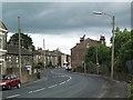
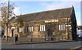
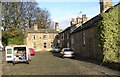
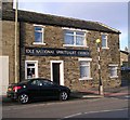
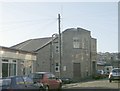
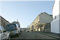
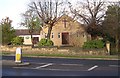
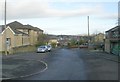
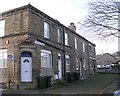
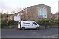
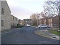
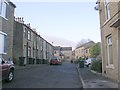
100 photos from this area
Area Information
Key information about the BD10 9LE including its size, population, and administrative classification.
- Area Type
- Postcode
- Area Size
- 1.1 hectares
- Population
- 1789
- Population Density
- 6380 people/km²
House Prices in BD10 9LE
22
Properties
£95,567
Average Sold Price
£35,000
Lowest Price
£210,000
Highest Price
Showing 22 properties
| Address | Type | Beds | Baths | Last Sale Price | Last Sale Date | |
|---|---|---|---|---|---|---|
| 9 Cavendish Road, Idle, Bradford, BD10 9LE | Terraced | 4 | 1 | £210,000 | Dec 2024 | |
| 15 Cavendish Road, Idle, Bradford, BD10 9LE | Terraced | 2 | 1 | £140,000 | Aug 2024 | |
| 17 Cavendish Road, Idle, Bradford, BD10 9LE | Terraced | 2 | 1 | £132,500 | Oct 2022 | |
| 5 Cavendish Road, Idle, Bradford, BD10 9LE | Terraced | 4 | - | £170,000 | Apr 2022 | |
| 21 Cavendish Road, Idle, Bradford, BD10 9LE | Terraced | 4 | 1 | £103,500 | Feb 2018 | |
| 23 Cavendish Road, Idle, Bradford, BD10 9LE | house | - | - | £112,000 | May 2017 | |
| 37 Cavendish Road, Idle, Bradford, BD10 9LE | Terraced | 3 | 1 | £86,000 | Nov 2015 | |
| 1 Cavendish Road, Idle, Bradford, BD10 9LE | Terraced | 2 | 1 | £55,000 | Apr 2014 | |
| 13 Cavendish Road, Idle, Bradford, BD10 9LE | house | 2 | - | £84,500 | Nov 2013 | |
| 3 Cavendish Road, Idle, Bradford, BD10 9LE | Terraced | - | - | £65,000 | Mar 2009 |
Page 1 of 3
Energy Efficiency in BD10 9LE
Amenities
Schools
| Rank | School | Type | Entry gender | Ages |
|---|
Explore more schools in this area
Go to Schools tabDemographics
Household Size
One person
most common
Accommodation Type
Flats
most common
Tenure
29
majority
Ethnic Group
White
most common
Religion
N/A
most common
Household Composition
N/A
most common
Age
47
median
Adults (30-64 years)
most common
Household Deprivation
N/A
with no deprivation
NS-SEC
17
in Lower managerial occupations
Explore more demographic insights in this area
Go to Demographics tabPlanning
Planning Constraints
- Flood RiskPremium
- Ramsar Wetland SitesPremium
- Area of Outstanding Natural BeautyPremium
- Protected Nature ReservePremium
- Protected WoodlandPremium