Area Overview for BD10 8UQ
Photos of BD10 8UQ
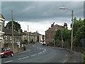
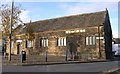
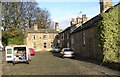
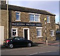
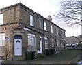

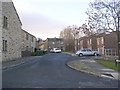
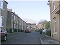
100 photos from this area
Area Information
Key information about the BD10 8UQ including its size, population, and administrative classification.
- Area Type
- Postcode
- Area Size
- 5.8 hectares
- Population
- 1802
- Population Density
- 3313 people/km²
House Prices in BD10 8UQ
15
Properties
£305,708
Average Sold Price
£99,000
Lowest Price
£500,000
Highest Price
Showing 15 properties
| Address | Type | Beds | Baths | Last Sale Price | Last Sale Date | |
|---|---|---|---|---|---|---|
| 94 Westfield Lane, Idle, Bradford, BD10 8UQ | Bungalow | 2 | 1 | £500,000 | Dec 2024 | |
| 57 Westfield Lane, Idle, Bradford, BD10 8UQ | Detached | 3 | 3 | £283,750 | Jun 2023 | |
| 49 Westfield Lane, Idle, Bradford, BD10 8UQ | house | - | - | £284,000 | Apr 2023 | |
| 96 Westfield Lane, Idle, Bradford, BD10 8UQ | house | - | - | £492,500 | Sep 2021 | |
| 106 Westfield Lane, Idle, Bradford, BD10 8UQ | Semi-detached | 3 | 2 | £175,000 | Jul 2019 | |
| 108 Westfield Lane, Idle, Bradford, BD10 8UQ | Semi-detached | - | - | £99,000 | Oct 1999 | |
| 53 Westfield Lane, Idle, Bradford, BD10 8UQ | Terraced | 3 | 3 | - | - | |
| 45 Westfield Lane, Idle, Bradford, BD10 8UQ | Semi-detached | 4 | 2 | - | - | |
| 55 Westfield Lane, Idle, Bradford, BD10 8UQ | house | 4 | 2 | - | - | |
| Caravan At, 94 Westfield Lane, Idle, Bradford, BD10 8UQ | Mobile Home | - | - | - | - |
Page 1 of 2
Energy Efficiency in BD10 8UQ
Amenities
Schools
| Rank | School | Type | Entry gender | Ages |
|---|
Explore more schools in this area
Go to Schools tabDemographics
Household Size
Family (3-5 people)
most common
Accommodation Type
Houses
most common
Tenure
88
majority
Ethnic Group
White
most common
Religion
N/A
most common
Household Composition
N/A
most common
Age
47
median
Adults (30-64 years)
most common
Household Deprivation
N/A
with no deprivation
NS-SEC
44
in Lower managerial occupations
Explore more demographic insights in this area
Go to Demographics tabPlanning
Planning Constraints
- Flood RiskPremium
- Ramsar Wetland SitesPremium
- Area of Outstanding Natural BeautyPremium
- Protected Nature ReservePremium
- Protected WoodlandPremium