Area Overview for BD1 4RY
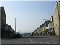
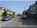
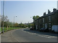
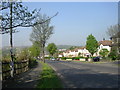
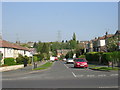
Photos of BD1 4RY
Area Information
Living in BD1 4RY means residing in a compact, densely populated residential cluster in England’s West Yorkshire. This postcode area covers 1.5 hectares and is part of the Bolton and Undercliffe ward, a historically significant suburb northeast of Bradford city centre. With a population of 2,833 people, the area has a population density of 2,731 people per square kilometre, reflecting its urban, residential character. The area is defined by its proximity to Bradford’s industrial and cultural heart, with historical roots in the 19th-century merger of former villages like Bolton. Daily life here is shaped by its proximity to retail, transport hubs, and educational institutions. The area’s compact size means residents are within walking or short-vehicle distance of key amenities, though its small footprint also means limited space for greenery or open land. The demographic profile, with a median age of 22 and a predominance of Asian residents, suggests a dynamic, young community navigating the challenges of high-density living in a historically evolving urban environment.
- Area Type
- Postcode
- Area Size
- 1.5 hectares
- Population
- 2833
- Population Density
- 2731 people/km²
The property market in BD1 4RY is characterised by a high proportion of rental properties and a scarcity of owner-occupied homes. With only 28% of households owning their homes, the area is predominantly a rental market, catering to tenants rather than buyers seeking long-term investment. Flats dominate the accommodation type, reflecting the area’s compact size and high density. This suggests a focus on smaller, more affordable units, which may appeal to young professionals or families seeking proximity to urban amenities. However, the limited availability of owner-occupied properties and the prevalence of flats could make the area less attractive to buyers seeking larger homes or equity growth. The small footprint of BD1 4RY also means that property values and availability are closely tied to the broader Bolton and Undercliffe ward, where semi-detached houses and bungalows are more common. For buyers, this area may be better suited to those prioritising location over property type or size.
House Prices in BD1 4RY
Showing 2 properties
| Address | Type | Beds | Baths | Last Sale Price | Last Sale Date | |
|---|---|---|---|---|---|---|
| Uriah Woodhead & Son, Canal Works, Canal Road, Bradford, BD1 4RY | warehouse | - | - | - | - | |
| Huws And Gray, Valley House, Valley Road, Bradford, BD1 4RY | retail_financial | - | - | - | - |
Energy Efficiency in BD1 4RY
Residents of BD1 4RY enjoy a lifestyle shaped by proximity to essential amenities. The area’s retail options include major supermarkets like Tesco Bradford and Farmfoods Manningham, ensuring easy access to groceries and daily essentials. Rail connectivity is robust, with five stations providing links to Bradford’s transport network and beyond. Leeds Bradford Airport is within reach, offering travel options for those reliant on air travel. While the area lacks large parks or green spaces, its compact design means residents can reach urban centres, cultural hubs, and leisure opportunities in Bradford quickly. The presence of multiple schools and community facilities suggests a focus on family-oriented living, though the high population density may limit private outdoor space. Overall, the area’s convenience and accessibility make it suitable for those prioritising urban connectivity over expansive natural environments.
Amenities
Schools
Residents of BD1 4RY have access to a range of educational institutions, including the Midland Road Nursery School, which provides early years education. For primary education, Wapping First School serves the area, while independent options include TLG Bradford and Al Mumin Primary and Secondary School, both of which have Ofsted ratings of satisfactory. The One In A Million Free School, an academy with a satisfactory Ofsted rating, adds to the diversity of school types. This mix of state, independent, and academy schools offers families choices, though the ratings suggest that while basic standards are met, there may be room for improvement in some institutions. The presence of multiple schools within practical reach reflects the area’s focus on accessibility, though the high population density may strain resources. Parents seeking higher-rated schools may need to look beyond the immediate vicinity.
| Rank | School | Type | Entry gender | Ages |
|---|
Explore more schools in this area
Go to Schools tabDemographics
The community in BD1 4RY is predominantly young, with a median age of 22 and the most common age range being adults aged 30–64. Only 28% of households are owner-occupied, with flats being the primary accommodation type. This reflects a rental-heavy market, where 72% of residents are likely to be tenants. The area’s predominant ethnic group is Asian, making up the largest share of the population. The ward’s deprivation levels are moderate, with priorities including better skills, jobs, and safer communities. Notably, 5.9% of households are overcrowded, a figure higher than the district average, which may impact living conditions. The population includes 24.1% under 16 and 11.5% aged 65–84, suggesting a mix of family households and older residents. Despite this diversity, the area’s high population density and limited home ownership options may present challenges for long-term stability or investment.
Household Size
Accommodation Type
Tenure
Ethnic Group
Religion
Household Composition
Age
Household Deprivation
NS-SEC
Explore more demographic insights in this area
Go to Demographics tabPlanning
Planning Constraints
- Flood RiskPremium
- Ramsar Wetland SitesPremium
- Area of Outstanding Natural BeautyPremium
- Protected Nature ReservePremium
- Protected WoodlandPremium