Area Overview for BD1 4RG
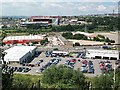
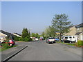
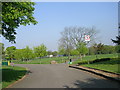
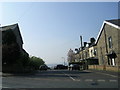
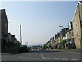
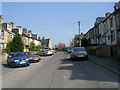
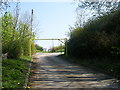
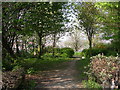
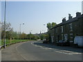
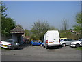
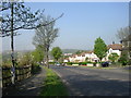
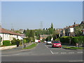
Photos of BD1 4RG
Area Information
Living in BD1 4RG means being part of a densely populated, small residential cluster in the heart of Bradford, West Yorkshire. With a population of 2,833 and a density of 2,731 people per square kilometre, this area is a compact urban hub within the City of Bradford Metropolitan District Council’s City Ward. It lies within the inner ring road, close to the city’s historical and administrative core. Daily life here is shaped by proximity to key amenities, including multiple railway stations, retail outlets, and schools. The area’s character is defined by its mix of residential flats and its role as a central urban node. While it lacks sprawling green spaces, its connectivity to transport networks and nearby airports—such as Leeds Bradford International Airport—makes it a practical choice for commuters. The community here is young on average, with a median age of 22, though the most common age group is adults aged 30–64, suggesting a balance of families and professionals. The area’s compact size means residents are likely to know their neighbours, though the high population density may influence the pace of urban life.
- Area Type
- Postcode
- Area Size
- Not available
- Population
- 2833
- Population Density
- 2731 people/km²
The property market in BD1 4RG is characterised by a high proportion of rental properties, with only 28% of homes owned by residents. Flats make up the majority of the housing stock, reflecting the area’s compact, urban nature. This suggests a market that caters more to renters than buyers, particularly those seeking affordable accommodation in a central location. The small size of the area means housing options are limited, and the dominance of flats may appeal to those prioritising convenience over space. For buyers, this could present challenges, as the scarcity of owner-occupied properties may drive competition for available homes. The high population density also means properties are likely to be in close proximity to one another, with little scope for expansion. Prospective buyers should consider the area’s rental-focused market and the potential for long-term appreciation, though the limited housing stock may restrict opportunities for investment.
House Prices in BD1 4RG
No properties found in this postcode.
Energy Efficiency in BD1 4RG
Residents of BD1 4RG enjoy a range of amenities within walking or short transit distance. Retail options include Farmfoods Manningham, Tesco Bradford, and Asda Living, offering everyday shopping needs. The area’s proximity to multiple railway stations—such as Bradford Forster Square and Bradford Interchange—facilitates easy travel to nearby towns and cities. Nearby airports, including Leeds Bradford International Airport, further enhance connectivity for travel. While the area lacks extensive green spaces, its urban setting provides access to cultural and commercial hubs. The compact nature of BD1 4RG means amenities are tightly clustered, reducing the need for long commutes. This convenience comes at the cost of limited private outdoor space, but the density supports a vibrant, service-rich environment. The mix of retail, transport, and travel options makes daily life efficient, though residents may seek nearby parks or recreational areas for leisure.
Amenities
Schools
Residents of BD1 4RG have access to a range of educational institutions, from nurseries to independent schools. Midland Road Nursery School provides early education, while Wapping First School serves primary-age children. For secondary education, Al Mumin Primary and Secondary School and One In A Million Free School offer independent options, both with Ofsted ratings of satisfactory. TLG Bradford is another independent school in the area. This mix of state and independent schools gives families choices, though the Ofsted ratings indicate that while standards are acceptable, they are not outstanding. The presence of multiple schools within practical reach suggests the area is well-served for families, though the quality of education may vary. Parents seeking high-performing schools may need to look beyond the immediate vicinity, as the local options are neither exceptional nor underperforming.
| Rank | School | Type | Entry gender | Ages |
|---|
Explore more schools in this area
Go to Schools tabDemographics
BD1 4RG has a median age of 22, but the most common age group among residents is adults aged 30–64, indicating a mix of younger and middle-aged populations. Only 28% of homes are owner-occupied, with flats being the predominant accommodation type. This suggests a rental market dominates, which may influence property values and investment opportunities. The area’s demographic profile is marked by a significant Asian_total population, reflecting broader trends in Bradford’s diversity. While no specific deprivation data is provided, the high proportion of renters and the prevalence of flats may indicate a community with varying economic profiles. The low home ownership rate could also imply a transient population, with many residents renting rather than purchasing. This dynamic may affect local services and amenities, as demand for housing and community facilities is shaped by a mix of long-term residents and those in temporary accommodation.
Household Size
Accommodation Type
Tenure
Ethnic Group
Religion
Household Composition
Age
Household Deprivation
NS-SEC
Explore more demographic insights in this area
Go to Demographics tabPlanning
Planning Constraints
- Flood RiskPremium
- Ramsar Wetland SitesPremium
- Area of Outstanding Natural BeautyPremium
- Protected Nature ReservePremium
- Protected WoodlandPremium