Area Overview for BD1 4PF
Photos of BD1 4PF


Area Information
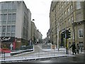
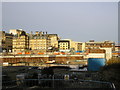
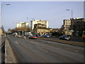
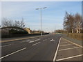
Living in BD1 4PF means being part of a compact, urban postcode area nestled within the heart of Bradford’s city centre. This small residential cluster, with a population of 1,860, sits within the City Ward, a historically significant electoral area defined by its central urban boundaries. The area’s proximity to key landmarks like Leeds Bradford Airport and multiple rail stations underscores its connectivity to broader regional networks. Daily life here is shaped by its role as a hub within Bradford’s inner ring road, offering easy access to retail, transport, and cultural amenities. While the area is small, it reflects the broader dynamics of Bradford’s urban core—vibrant yet pragmatic. Residents benefit from a mix of nearby shops, including Asda Living and Tesco Bradford, and frequent rail services that link to surrounding towns. The demographic profile, with a median age of 22 but a majority of adults aged 30–64, suggests a blend of young professionals and established families navigating the challenges and opportunities of city living.
- Area Type
- Postcode
- Area Size
- Not available
- Population
- 1860
- Population Density
- 4297 people/km²
The property market in BD1 4PF is characterised by a near-absence of owner-occupied homes, with only 3% of properties owned by residents. This suggests a rental-dominated market, where flats are the primary accommodation type. Such a dynamic may appeal to buyers seeking investment opportunities or short-term rental properties, though the small area’s limited housing stock means competition is likely fierce. The prevalence of flats, often associated with urban living, reflects the area’s density and proximity to transport links. For buyers, this environment may present challenges in securing long-term ownership, but it also highlights the area’s role as a transitional or rental-focused zone. Those considering the area should weigh the practicalities of renting against the potential for capital growth in a market where property is predominantly leased.
House Prices in BD1 4PF
No properties found in this postcode.
Energy Efficiency in BD1 4PF
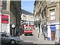
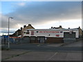
Daily life in BD1 4PF is shaped by its urban setting and access to essential amenities. Within walking distance are retail outlets such as Iceland Manningham, Asda Living, and Tesco Bradford, offering convenience for grocery shopping and daily essentials. The area’s rail network, with five stations including Bradford Foster Square, ensures easy access to nearby towns and cities, while Leeds Bradford Airport provides regional travel options. Though the data does not specify parks or leisure facilities, the urban layout suggests a focus on functional living over expansive green spaces. The presence of multiple retail and transport hubs indicates a practical, fast-paced lifestyle, ideal for those prioritising accessibility over rural tranquillity.
Amenities
Schools
| Rank | School | Type | Entry gender | Ages |
|---|
Explore more schools in this area
Go to Schools tabDemographics
BD1 4PF’s population of 1,860 is predominantly composed of adults aged 30–64, despite a median age of 22. This suggests a community where younger residents may be students or workers coexisting with a larger middle-aged demographic. Home ownership is exceptionally low at 3%, indicating that most residents are renters, likely in flats given the area’s accommodation type. The predominant ethnic group is White, reflecting broader trends in Bradford’s city centre. While specific data on deprivation is not provided, the low home ownership rate and focus on rental properties may imply a transient population or economic pressures affecting long-term stability. The age distribution highlights a mix of career-focused individuals and those in later life stages, shaping a community that balances youthful energy with established routines.
Household Size
Accommodation Type
Tenure
Ethnic Group
Religion
Household Composition
Age
Household Deprivation
NS-SEC
Explore more demographic insights in this area
Go to Demographics tabPlanning
Planning Constraints
- Flood RiskPremium
- Ramsar Wetland SitesPremium
- Area of Outstanding Natural BeautyPremium
- Protected Nature ReservePremium
- Protected WoodlandPremium