Area Overview for Barugh Green and Redbrook
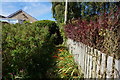
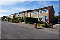
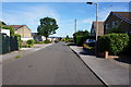
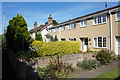
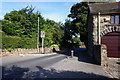
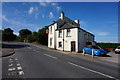
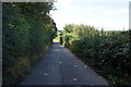
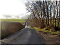
Photos of Barugh Green and Redbrook
Area Information
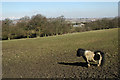
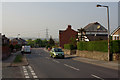
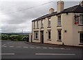
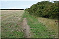
Barugh Green and Redbrook occupies a specific niche within the South Yorkshire landscape as a built-up area spanning just 2.5 square kilometres. This compact footprint creates a concentrated community where daily routines often rely on proximity rather than extensive travel. Living in Barugh Green and Redbrook means navigating a tightly knit environment that blends residential streets with essential local infrastructure. The area functions as a distinct locality within the wider Barnsley context, offering residents a manageable scale for getting around without the sprawling chaos of larger urban centres. You will find that life here revolves around established neighbourhood patterns typical of pastoral villages that have developed into residential zones. The small size of the area suggests a focus on immediate surroundings and local convenience. While the area does not boast monumental commercial districts or large leisure complexes, its intimate scale fosters a sense of familiarity among neighbours. Homes in Barugh Green and Redbrook sit within a recognised boundary that separates them from larger towns like Barnsley or Gawber, yet they benefit from their closeness to these more significant hubs. This distinction makes the area attractive to those seeking a quiet residence close to urban amenities, without being immersed in city traffic. The character of the place is defined by its residential density and its strategic position relative to nearby transport links. Prospective buyers looking for a home in this specific 2.5 square kilometre zone are entering a market where location-specific factors dominate the decision-making process.
- Area Type
- Built Up Area 250
- Area Size
- 2.5 km²
- Population
- Not available
- Population Density
- Not available
Your daily life in Barugh Green and Redbrook will be supported by a selection of essential amenities located within practical reach. For your shopping and weekly essentials, the area benefits from the presence of Aldi Barugh, a local branch of the major supermarket chain. You will also find that larger departments are accessible; Sainsburys Barnsley and Tesco Barnsley serve the wider catchment including Barugh Green and Redbrook. These supermarkets provide supermarkets, fresh produce, and household goods just a short drive or journey away. Despite the small size of the area, rail transport is well-represented with five notable stations serving residents. Darton Railway Station and Dodworth Railway Station offer local connectivity for daily commuters, while Barnsley Railway Station acts as a major interchange. This abundance of rail links ensures that you can reach major transport hubs quickly without needing a car for every journey. The character of the area is defined by this balance of local village conveniences and access to larger town services. You do not need to travel far for basic needs, but you can easily reach expanded leisure or dining options in Barnsley. Living in Barugh Green and Redbrook offers a lifestyle that prioritises convenience without isolation, relying on a few key venues like Aldi Barugh for local commerce and the rail network for broader mobility.
Amenities
Schools
Families considering schools near Barugh Green and Redbrook have access to a limited but notable selection of educational institutions within practical reach. The most prominent local facility is Barugh Green Primary School, which serves as a dedicated local option for younger children. You will also find Gawber Primary School nearby, an institution that holds an outstanding Ofsted rating, indicating a high standard of educational provision. This status adds weight to the area's appeal for education-focused buyers. Beyond the primary level, Whinmoor School is situated in the vicinity and serves as a special school. This designation is important for families with specific educational needs, as it provides specialist support within the local catchment area. While the area does not contain secondary schools within its 2.5 square kilometre perimeter, the presence of these specific primary and special education schools offers a targeted range of options. The mix of an outstanding-rated primary school and a special provision school defines the educational landscape here. You will not find comprehensive sixth-form colleges locally, meaning older students often commute to larger towns. However, for younger children living in Barugh Green and Redbrook, the proximity to a Gold-rated primary and a specialist provision offers a comfortable local education model. Parents should weigh the distance to higher education colleges when planning their family's schooling journey.
| Rank | A + A* % | School | Type | Entry gender | Ages |
|---|---|---|---|---|---|
| 1 | N/A | Barugh Green Primary School | primary | N/A | N/A |
| 2 | N/A | Gawber Primary School | primary | N/A | N/A |
| 3 | N/A | Whinmoor School | special | N/A | N/A |
| 4 | N/A | Barugh Green Primary School | primary | N/A | N/A |
Explore more schools in this area
Go to Schools tabDemographics
The community makeup of Barugh Green and Redbrook skews heavily towards older residents, with a median age of 70 years. This demographic profile indicates that the area is primarily inhabited by retirees or individuals who have moved here during later life stages. When you consider the age structure, you are dealing with a population where the majority falls well above the national average for working-age adults. This has direct implications for local services, social activities, and the overall energy of the streets. Home ownership stands at an impressive 77%, a figure that significantly influences the character of the neighbourhood. Such a high rate of ownership suggests a settled population with a long-term commitment to their homes. You are less likely to encounter high transient rates or short-term letting fluctuations in Barugh Green and Redbrook compared to student-heavy university towns. This stability often fosters stronger neighbourly bonds and a slower pace of life. The area lacks data on specific household composition percentages or predominant ethnic and religious groups. However, the high home ownership rate and advanced median age strongly suggest a community centred on long-term residents rather than young professionals or families with young children. This demographic reality shapes the local culture, from the types of social clubs available to the services that operate most efficiently here. Living in Barugh Green and Redbrook means joining a community defined by seniority and stability.
Household Size
Accommodation Type
Tenure
Ethnic Group
Religion
Household Composition
Age
Household Deprivation
NS-SEC
Explore more demographic insights in this area
Go to Demographics tabPlanning
Planning Constraints
- Crime RiskLocked