Area Overview for Barnburgh and Harlington
Photos of Barnburgh and Harlington
Area Information
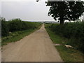
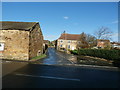
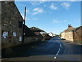
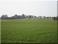
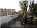
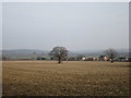
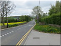
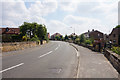
Barnburgh and Harlington is a built-up area in England covering 59.2 hectares, shaped by its compact layout and proximity to key transport links. The area’s population reflects a median age of 70, suggesting a community with a significant proportion of older residents. This demographic is mirrored in the 74% home ownership rate, indicating a stable, long-term resident base. Daily life here is defined by practicality, with residents relying on nearby amenities such as retail outlets, rail stations, and the Parkgate metro for connectivity. The presence of two primary schools—Barnburgh Primary School and Barnburgh Primary Academy—highlights the area’s focus on education, though no further details on school performance are available. While the broadband score is low at 27, mobile coverage is robust at 84, supporting digital needs for those working remotely or accessing online services. Barnburgh and Harlington is not a place for those seeking a fast-paced urban lifestyle, but it offers a quiet, community-oriented environment with accessible transport and essential services within reach.
- Area Type
- Built Up Area 250
- Area Size
- 59.2 hectares
- Population
- Not available
- Population Density
- Not available
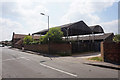
The lifestyle in Barnburgh and Harlington is shaped by its accessible amenities, including five retail outlets such as Morrisons Daily, Asda Goldthorpe, and Tesco Bolton. These shops provide essential shopping options, reducing the need for long commutes. The rail stations and Parkgate metro station enhance mobility, allowing residents to reach nearby towns or cities for additional services. While the area lacks detailed information on parks or leisure facilities, the presence of multiple retail and transport hubs suggests a practical, community-focused daily life. The compact size of the area—59.2 hectares—means amenities are closely clustered, supporting a walkable environment. However, the absence of specific data on recreational spaces or dining options means residents may need to look beyond the immediate vicinity for cultural or leisure activities.
Amenities
Schools
Residents of Barnburgh and Harlington have access to two primary schools: Barnburgh Primary School and Barnburgh Primary Academy. Both institutions cater to younger children, though the dataset does not include Ofsted ratings or academic performance metrics. The presence of two primary schools within the area provides families with options for their children’s early education, though the lack of secondary schools nearby may require commuting for older students. The focus on primary education suggests a community prioritising early learning, but further details on school facilities or extracurricular offerings are not available. Families considering the area should investigate the quality of these schools independently, as the data does not provide direct assessments.
| Rank | School | Type | Entry gender | Ages |
|---|
Explore more schools in this area
Go to Schools tabDemographics
The demographic profile of Barnburgh and Harlington is marked by a median age of 70, the highest in the dataset, suggesting a population skewed toward older adults. This is reflected in the 74% home ownership rate, which aligns with a community of long-term residents rather than a transient population. The data does not specify household composition or ethnic diversity, but the “total” category for accommodation types and predominant ethnic groups implies a lack of detailed breakdowns. The area’s age profile may influence local services and infrastructure, with healthcare and leisure facilities likely tailored to older adults. While no deprivation metrics are provided, the high median age and stable home ownership suggest a relatively cohesive community, though it may face challenges related to age-related needs such as mobility support and healthcare access.