Area Overview for Barlby
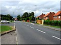
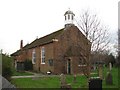
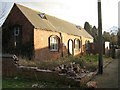
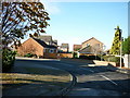
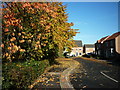
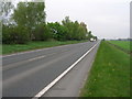
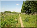
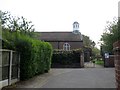
Photos of Barlby
Area Information
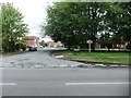
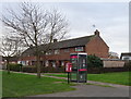
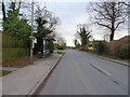
Barlby is a compact built-up area spanning 80.4 hectares in England, offering a quiet, established living environment. With a median age of 70, it is a community characterised by older residents, suggesting a mature demographic profile. The area’s home ownership rate of 78% indicates a stable housing market, with many properties likely to be long-term family homes. Daily life in Barlby is shaped by its proximity to essential services, including two railway stations—Selby and Wressle—offering connections to nearby towns. The presence of schools such as Barlby Community Primary School and Barlby High School ensures families have access to local education. While the area is small, its amenities are practical, with retail options like Budgens and Sainsburys within reach. Barlby’s charm lies in its balance of accessibility and tranquillity, making it suitable for those seeking a settled, low-maintenance lifestyle without sacrificing convenience.
- Area Type
- Built Up Area 250
- Area Size
- 80.4 hectares
- Population
- Not available
- Population Density
- Not available
Barlby’s lifestyle is shaped by its proximity to essential amenities. Retail options include Budgens Barlby, Farmfoods Selby, and Sainsburys Selby, providing access to groceries, household goods, and daily necessities. These stores are within practical reach, reducing the need for long journeys. The two nearby railway stations—Selby and Wressle—enhance mobility, connecting residents to broader networks for work, shopping, or leisure. While the area lacks detailed data on parks or leisure facilities, its retail and transport links suggest a functional, community-focused environment. The combination of local shopping and rail access ensures residents can manage daily tasks efficiently, supporting a low-stress, convenient lifestyle.
Amenities
Schools
Barlby offers a range of educational options, including Barlby Community Primary School, which holds a ‘good’ Ofsted rating. This school provides a solid foundation for younger children, though its primary focus may limit its capacity for older students. For secondary education, Barlby High School operates as both a primary and academy school, with the latter receiving a ‘satisfactory’ Ofsted rating. The presence of two schools under the same name suggests potential overlaps in service areas or administrative structures. Families should consider visiting both institutions to assess their suitability. The mix of school types ensures local coverage but may require careful planning for transitions between educational stages.
| Rank | A + A* % | School | Type | Entry gender | Ages |
|---|---|---|---|---|---|
| 1 | N/A | Barlby Community Primary School | primary | N/A | N/A |
| 2 | N/A | Barlby High School | primary | N/A | N/A |
| 3 | N/A | Barlby High School | academy | N/A | N/A |
Explore more schools in this area
Go to Schools tabDemographics
Barlby’s population is predominantly older, with a median age of 70, reflecting a community where retirees and long-term residents form the majority. The home ownership rate of 78% suggests a strong presence of owner-occupied properties, which may indicate a stable, less transient population. While the data does not specify household composition or ethnic diversity, the overall figures suggest a cohesive, homogenous community. The absence of detailed breakdowns on accommodation types or household structures means the area’s demographic nuances remain partially unexplored. However, the high home ownership rate implies a focus on long-term residency rather than rental turnover. For buyers, this could mean a market with fewer speculative properties and a preference for established homes.
Household Size
Accommodation Type
Tenure
Ethnic Group
Religion
Household Composition
Age
Household Deprivation
NS-SEC
Explore more demographic insights in this area
Go to Demographics tabPlanning
Planning Constraints
- Crime RiskLocked