Area Overview for Armley Ward
Photos of Armley Ward
Area Information
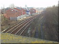
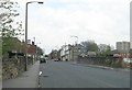
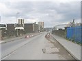
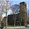
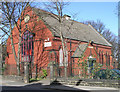
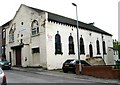
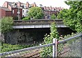
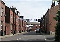
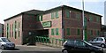
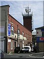
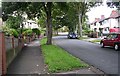
Armley Ward offers a distinctive contrast between historic industrial heritage and modern convenience. This electoral ward and district sits in the west of Leeds, sitting less than one mile from the city centre. The area covers 5.9 square kilometres and represents a predominantly working-class urban environment. Its character is defined by rows of back-to-back terraced houses and 19th-century development, including artisan and middle-class homes around St Bartholomew's Church. You are living in a place where the Leeds and Liverpool Canal once stimulated significant growth, and where Armley Mills, the world's largest woollen mill, stood from 1788 to 1805. Today, the landscape includes listed Grade II* structures like the Leeds Industrial Museum and HM Prison Leeds, alongside the Armley Conservation Area which preserves early town street layouts. Daily life here blends proximity to Leeds with a history of textile production. The population resides within a managed urban setting that retains smaller industrial businesses. You will find yourself neighbours with a community shaped by post-war redevelopment following the 1941 Blitz damage and subsequent slum clearances. The area is home to notable landmarks such as Armley Park, Armley Cemetery, and the Grade II*-listed Gotts Park Mansion, historically linked to industrialist Benjamin Gott. If you seek a neighbourhood with a tangible connection to Yorkshire's industrial past while remaining close to urban amenities, Armley Ward delivers this without the typical marketing fluff. The ward remains an integral part of Leeds City Council, reflecting its continued relevance in the local governance structure.
- Area Type
- District Borough Unitary Ward
- Area Size
- 5.9 km²
- Population
- 6040
- Population Density
- 1023 people/km²
Demographics
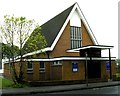
The community within Armley Ward displays a specific demographic profile that shapes its character. Residents here have a median age of 70 years old, indicating a population with a significant proportion of older adults. This older age range suggests a quiet residential environment where people may settle for longer periods, potentially influencing the pace of daily life. Approximately 41 per cent of households own their homes, which places the area in a context where renting is still a common arrangement. This ownership level does not constitute a purely private housing stock, though it reflects a stable segment of the neighbourhood. The total population count stands at 6040 people, distributed across an area of 5.9 square kilometres. This results in a population density of 1023 people per square kilometre, meaning you are living in a moderately dense urban setting. The ward contains 51 listed buildings, including churches, schools, public houses, and a public library, which serve the local community. The historical context notes that the civil parish was abolished in 1904 to form Armley and Bramley, adding layers to the local identity. There is no specific data provided on household composition breakdowns or the predominant ethnic groups within the ward. Similarly, detailed religious statistics are not included in the available research. These gaps do not obscure the primary facts: a reasonably dense area with a mature age profile and a modest home ownership rate.
Household Size
Accommodation Type
Tenure
Ethnic Group
Religion
Household Composition
Age
Household Deprivation
NS-SEC
Explore more demographic insights in this area
Go to Demographics tabPlanning
Planning Constraints
- Flood RiskPremium
- Ramsar Wetland SitesPremium
- Area of Outstanding Natural BeautyPremium
- Protected Nature ReservePremium
- Protected WoodlandPremium
- Crime RiskPremium