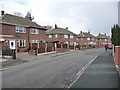
Area Overview for Allerton Bywater
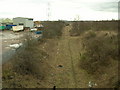
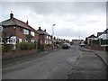
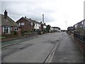
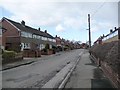
Photos of Allerton Bywater


Area Information
Living in Allerton Bywater offers a distinct blend of practicality and proximity to essential services. Situated in England, this built-up area spans 57.2 hectares, creating a compact environment where daily life is shaped by its infrastructure and community dynamics. The median age of residents is 70, suggesting a population skewed towards older adults, which influences the area’s character and needs. Home ownership here is robust, with 74% of households owning their properties, indicating a stable residential base. The area’s appeal lies in its accessibility to nearby amenities, including five retail outlets such as Tesco Allerton and Spar, and five rail stations like Castleford and East Garforth, which connect residents to broader networks. While the community is not defined by youthful energy, its established nature offers a sense of continuity. For those prioritising convenience over trendiness, Allerton Bywater provides a straightforward living experience, with services and transport options within practical reach. The presence of a primary school, Allerton Bywater Infant School, ensures families have access to early education, though the area’s demographic profile suggests a focus on mature, settled households over transient populations.
- Area Type
- Built Up Area 250
- Area Size
- 57.2 hectares
- Population
- Not available
- Population Density
- Not available
The lifestyle in Allerton Bywater is shaped by its proximity to essential retail and transport hubs. Within practical reach are five retail outlets, including Tesco Allerton and Spar, ensuring residents have access to everyday shopping needs without long commutes. The presence of multiple rail stations—such as Castleford and East Garforth—enhances mobility, connecting the area to regional centres and employment opportunities. While the data does not mention parks or leisure facilities, the compact nature of the area suggests that local amenities are concentrated, reducing the need for travel. The character of daily life here is defined by convenience and accessibility, with services clustered to serve a mature population. For those who prioritise ease of access over expansive recreational spaces, Allerton Bywater provides a straightforward, functional living environment. The combination of retail options and rail links ensures that residents can manage daily tasks efficiently, though the absence of detailed information on leisure facilities means further local research is advisable for those seeking specific recreational opportunities.
Amenities
Schools
The educational landscape near Allerton Bywater includes Allerton Bywater Infant School, a primary institution serving the area. No secondary schools or other educational facilities are listed in the data, meaning families may need to look beyond the immediate vicinity for comprehensive schooling. The presence of a primary school ensures that young children have access to early education within walking distance, which is a key consideration for families. However, the absence of secondary schools or specialist provisions could necessitate travel for older students, potentially impacting convenience. The single listed school suggests a focus on early years education, aligning with the area’s demographic profile of older residents. For those prioritising proximity to schools, Allerton Bywater offers a basic foundation but may require additional planning for long-term educational needs.
| Rank | A + A* % | School | Type | Entry gender | Ages |
|---|---|---|---|---|---|
| 1 | N/A | Allerton Bywater Infant School | primary | N/A | N/A |
Explore more schools in this area
Go to Schools tabDemographics
The demographics of Allerton Bywater reflect a population with a median age of 70, placing it well above the national average. This indicates a community predominantly composed of older adults, which shapes local services and social structures. The most common age range is listed as “Age: Total,” suggesting aggregated data that may not isolate specific generational groups. Home ownership is high, with 74% of residents owning their homes, a figure that underscores the area’s stability and long-term residency patterns. Accommodation types and household composition data are categorised as “total,” meaning no breakdown of family structures or property types is available. Similarly, the predominant ethnic group and religious affiliation are not specified, leaving a gap in understanding the area’s cultural diversity. However, the high home ownership rate implies a mature, settled population with fewer transient residents. For those considering Allerton Bywater, the demographic profile suggests a community that prioritises security and continuity over rapid change, with a focus on established living rather than dynamic growth.
Household Size
Accommodation Type
Tenure
Ethnic Group
Religion
Household Composition
Age
Household Deprivation
NS-SEC
Explore more demographic insights in this area
Go to Demographics tabPlanning
Planning Constraints
- Crime RiskLocked