Area Overview for WR12 7PH
Photos of WR12 7PH

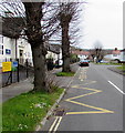
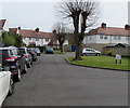
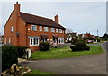
64 photos from this area
Area Information
Key information about the WR12 7PH including its size, population, and administrative classification.
- Area Type
- Postcode
- Area Size
- 37.1 hectares
- Population
- 1689
- Population Density
- 51 people/km²
House Prices in WR12 7PH
39
Properties
£628,660
Average Sold Price
£120,000
Lowest Price
£1,668,500
Highest Price
Showing 39 properties
| Address | Type | Beds | Baths | Last Sale Price | Last Sale Date | |
|---|---|---|---|---|---|---|
| The Field, Broadway Road, Willersey, WR12 7PH | Bungalow | 4 | 2 | £925,000 | Mar 2024 | |
| Beech House, Broadway Road, Willersey, WR12 7PH | Detached | 4 | 3 | £592,500 | Nov 2023 | |
| Cotswold House, Broadway Road, Willersey, WR12 7PH | Detached | 4 | 2 | £930,000 | Sep 2023 | |
| Wrens Wood, Broadway Road, Willersey, WR12 7PH | Detached | 2 | 2 | £394,000 | Jul 2023 | |
| Mendelssohn Cottage, Broadway Road, Willersey, WR12 7PH | house | - | - | £300,000 | Dec 2022 | |
| Warners Farm, Broadway Road, Willersey, WR12 7PH | house | - | - | £1,668,500 | Apr 2022 | |
| Hill View, Broadway Road, Willersey, WR12 7PH | Bungalow | - | - | £597,555 | Apr 2022 | |
| Elm House, Broadway Road, Willersey, WR12 7PH | house | - | - | £525,000 | Apr 2021 | |
| Nut Grove, Broadway Road, Willersey, WR12 7PH | house | - | - | £525,000 | Nov 2020 | |
| Brookroyd, Broadway Road, Willersey, WR12 7PH | Bungalow | - | - | £425,000 | Sep 2018 |
Page 1 of 4
Energy Efficiency in WR12 7PH
Amenities
Schools
| Rank | School | Type | Entry gender | Ages |
|---|
Explore more schools in this area
Go to Schools tabDemographics
Household Size
Two person
most common
Accommodation Type
Houses
most common
Tenure
73
majority
Ethnic Group
White
most common
Religion
N/A
most common
Household Composition
N/A
most common
Age
47
median
Adults (30-64 years)
most common
Household Deprivation
N/A
with no deprivation
NS-SEC
38
in Lower managerial occupations
Explore more demographic insights in this area
Go to Demographics tabPlanning
Planning Constraints
- Flood RiskPremium
- Ramsar Wetland SitesPremium
- Area of Outstanding Natural BeautyPremium
- Protected Nature ReservePremium
- Protected WoodlandPremium