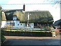
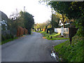
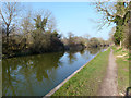
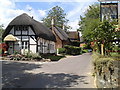
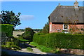
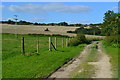
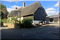
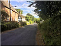
Area Overview for Wootton Rivers
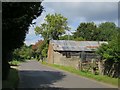
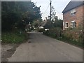
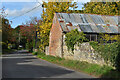
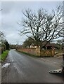
Photos of Wootton Rivers
Area Information
Living in Wootton Rivers means residing within a compact built-up area covering 21.0 hectares in the county of England. This small town functions as a distinct community rather than a sprawling urban environment. The area offers a concentrated living experience where residents know their surroundings well. With a median age of 70, the demographic profile suggests a settlement drawn to by older households and retirees. Daily life here revolves around local convenience and a quieter pace of existence away from larger city centres. You will find homes in this neighbourhood situated at a scale that prioritises accessibility over urban density. The setting provides a clear sense of place defined by its limited footprint. Prospective buyers looking for a traditional English town setting will recognise Wootton Rivers immediately. The land use is entirely built-up, meaning there is no separate surrounding green belt or rural perimeter within the official definition. This specific configuration shapes the character of the locality and influences how residents interact with the space. The area functions as a self-contained unit for those who move here seeking stability and established local patterns. Understanding what life in this specific hectare range entails is crucial for anyone considering a move. The size dictates that driving or walking to nearby hubs is often necessary for broader access. You are entering a environment where the built environment dominates the landscape. The distinct identity of Wootton Rivers comes from this tight-knit structure and the specific age group that dominates population statistics.
- Area Type
- Built Up Area 250
- Area Size
- 21.0 hectares
- Population
- Not available
- Population Density
- Not available
Your daily routine in Wootton Rivers is supported by a cluster of amenities within practical reach. For your shopping needs, five retail outlets are located nearby. You can visit the Co-op in Pewsey or use the Spar and Budgens branches in Marlborough. These specific venues provide your weekly groceries and essential household items without requiring travel to distant county towns. Public transport access is also defined by concrete destinations. The area has direct links to two railway stations: Pewsey Railway Station and Bedwyn Railway Station. These stations are your main gates for regional travel. The presence of these transport hubs means you have options for commuting or leisure trips without needing to drive every time you travel. These specific amenities create a functional lifestyle where basic daily commerce and regional travel are manageable without excessive effort. You will find that living in Wootton Rivers relies on these named services rather than a village core packed with independent shops. The reliance on Pewsey and Marlborough for retail and transport means your shopping trips are purposeful. The convenience of having two railway stations nearby is a key factor in the location's appeal. For residents, this arrangement balances local small-town comfort with access to established transport infrastructure. The lifestyle is practical, anchored by these specific named locations just outside the immediate neighbourhood.
Amenities
Schools
| Rank | School | Type | Entry gender | Ages |
|---|
Explore more schools in this area
Go to Schools tabDemographics
The community within Wootton Rivers is heavily skewed towards an older resident base. Data confirms that the median age of people living in the area is 70 years. This statistical marker indicates that half of the population is older than this age, while the other half is younger. The total household composition and accommodation type records are available, showing the broad structure of the housing within these 21 hectares. A significant majority of residents, specifically 72%, own their homes outright or have a mortgage. This 72% home ownership rate creates a settled community with long-term residents embedded in the local infrastructure. Fewer people in this area rent compared to many other parts of England. The demographic data highlights a location that acts as a retirement hub or a final choice for older couples and singles. Ethnicity and religious breakdowns are recorded in the official statistics, though specific predominant groups are noted generally in the source data. The lack of young families is a defining feature here. You are moving into a zone where neighbours likely share similar life stages and priorities. When you assess what living in Wootton Rivers feels like, the numbers tell the story. The high ownership percentage suggests stability and a resistance to short-term letting. The age profile means that community energy stems from older generations rather than children's schools or youth groups. Understanding these figures prevents you from underestimating the quiet nature of the daily routine. The demographic reality is clear and defined by these specific hard facts about the population structure.
Household Size
Accommodation Type
Tenure
Ethnic Group
Religion
Household Composition
Age
Household Deprivation
NS-SEC
Explore more demographic insights in this area
Go to Demographics tabPlanning
Planning Constraints
- Crime RiskPremium